
Population 95,084 (2008) Number of airports 1 | Local time Monday 8:12 AM | |
 | ||
Weather 25°C, Wind SE at 6 km/h, 91% Humidity | ||
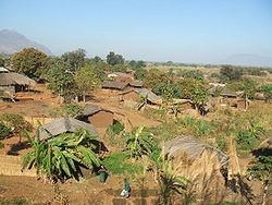
Practical training on clts cuamba niassa mozambique
Cuamba is a city and district of Niassa Province in Mozambique, lying north west of Mount Namuli. Before independence the town was known as Nova Freixo (New Ash).
Contents
- Practical training on clts cuamba niassa mozambique
- Map of Cuamba Mozambique
- Gest o de residuos solidos no municipio de cuamba
- History
- Transport
- Education
- References
Map of Cuamba, Mozambique
It lies on the EN8 road, which connects it to the city of Nampula in the east and to the Malawian border in the west.
Gest o de residuos solidos no municipio de cuamba
History
Cuamba was created by the Niassa Company, a royal charter company in what was then known as Portuguese East Africa. The land concession of the Niassa Company extended from 1891 and 1929, and it established a military outpost initially called Kuamba in this period. The name referred to a small kingdom in the area, and Cuamba became the official name of the settlement in 1937. Its name was changed to Nova Freixo in 1952, a reference to the city of Freixo de Espada à Cinta, Portugal, the birthplace of Sarmento Rodrigues (1899-1979), the colonial governor-general of Mozambique. The town reverted to its original name of Cuamba in 1976, and was elevated to city status in 1971.
Transport
It lies on the junction of the railway line from Nacala to Nampula and the branchline to Lichinga. Also There is an airport in the city called Cuamba Airport.
Education
The town is home to the School of Agriculture of the Catholic University of Mozambique.