
Postcode(s) 4285 | Postal code 4285 | |
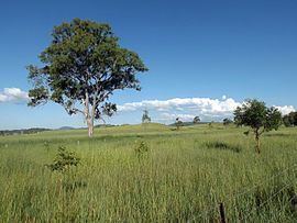 | ||
Cryna is a locality in the Scenic Rim Region of South East Queensland, Australia.
Contents
Map of Cryna QLD 4285, Australia
Geography
Part of the western border is marked by the Mount Lindesay Highway. Part of the northern boundary follow Spring Creek. The main land use in the area is agriculture. Parts of the central area are elevated along a ridge marking the northern extent of Jinbroken Range.
History
The Beaudesert Shire Tramway passed through the area but did not have a station. The closest station was at Josephville or the terminus in Beaudesert.
References
Cryna, Queensland Wikipedia(Text) CC BY-SA