
Postcode(s) 4285 | Postal code 4285 | |
 | ||
Nindooinbah is a rural locality in the Scenic Rim Region, Queensland, Australia.
Contents
Map of Nindooinbah QLD 4285, Australia
Geography
Nindooinbah occupies a part of the upper Albert River valley where Cainbable Creek joins the river. The Albert River also marks portions of both the eastern and western borders. In the east of the locality the slopes of Mount Witheren reach more than 550 m above sea level. Farming dominates the lower central areas along two main roads aligned in a north/south direction.
History
The name Nindooinbah is derived from the name of a pastoral run of 1842/3, based on Aboriginal words: nguin meaning charcoal / cinders, doan meaning black' and ba meaning place, indicating the place of the remains of a fire.
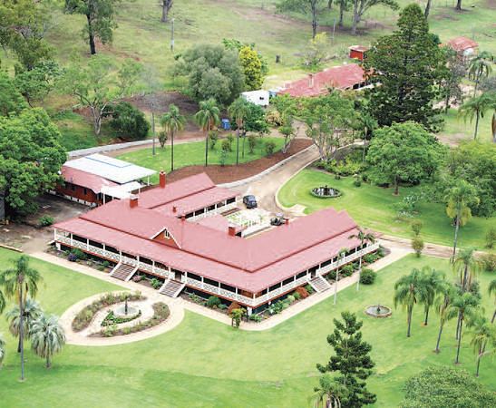
Heritage listings
Nindooinbah has a number of heritage-listed sites, including:
References
Nindooinbah, Queensland Wikipedia(Text) CC BY-SA