
Prominence < 10 m OS grid SO225207 | Translation Hywel's mound (Welsh) Location Black Mountains, Wales Elevation 451 m | |
 | ||
Similar Pen Cerrig‑calch, Pen Allt‑mawr, Sugar Loaf - Monmouthshire, Crug Mawr, Pen Twyn Glas | ||
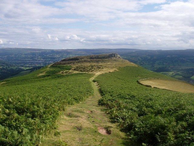
Crug Hywel (called the Table Mountain in English) is a flat-topped mountain at the southern edge of the Black Mountains in south-east Wales. It rises to 451 m above sea level, from the southern flank of Pen Cerrig-calch (701 m), and overlooks the town of Crickhowell, to which it gives its name.
Contents
Map of Crug Hywel, Crickhowell, UK
Crug Hywel's summit is entirely taken up by an Iron Age Celtic hillfort, with a clearly visible earth and stone ditch and rampart. Crug Hywel is approached by a couple of public footpaths across farmland from Crickhowell and Llanbedr and visited by the Beacons Way. It lies within an area designated as open country over which the public have the right to roam.
Geology
The hill is formed from Old Red Sandstone originating in the Devonian period, specifically the sandstones of the Brownstones Formation, topped by rocks of the Quartz Conglomerate Group. The whole mass of rocks forming this outlier of Pen Cerrig-calch can readily be seen to dip more sharply to the south than nearby strata and is considered to be an excellent example of a translational slide.