
Elevation 1,177 m | ||
 | ||
Similar Koritnik, Paštrik, Đeravica, Ljuboten, Mokra Gora | ||
Crnoljeva (Serbian Cyrillic: Црнољева; Albanian: Carralevë or Mali i Carralevës) is a mountain in central Kosovo, dividing its two main geographical regions, the Kosovo Plain and Metohija. Crnoljeva is also a point where all three drainage basins of Serbia (and three out of four in the Balkans) meet, making the mountain a major hydrographic knot. In Albanian it is named after the village of Carraleva.
Map of Crnoljeva
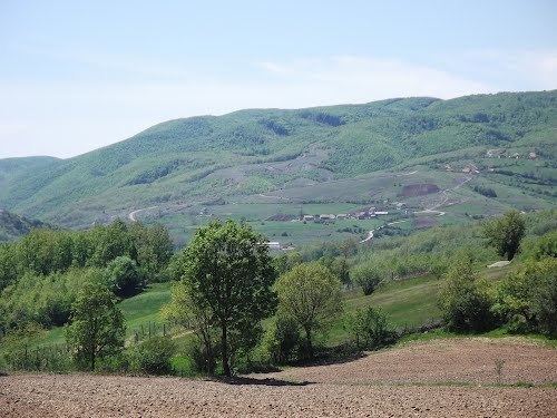
Crnoljeva is located in the south-central part of Kosovo, between the valleys of the rivers Drenica (to the east) and Miruša and Topluga (to the west). The mountain is elongated in the north-south direction and divides the Prizren depression of the Metohija from the Drenica region of the Kosovo Plain. The highest peak is Topila (1,177 m), while the Drmanska glava peak (926 m) is point of the hydrographic knot. Another prominent peak is the Korenik (1,142 m).
Crnoljeva is rich in ores, most notably the chromium, magnesite and coal. Right through the middle of the mountain goes the regional Uroševac-Prizren road, using the natural route of the Crnoljeva reka river valley.
Some rivers originating from the mountain are:
Larger settlements around the Crnoljeva are Štimlje (east), Suva Reka, Blace, Banja, Mališevo (west), Lapušnik, Komorane (north) and Carraleva (east).