
Country Serbia Settlements 25 Postal code 16215 Local time Saturday 5:58 PM | District Jablanica Time zone CET (UTC+1) Area 312 km² | |
 | ||
Weather 9°C, Wind SE at 13 km/h, 54% Humidity Neighborhoods Štutgart, Livađe, Andak, Kamen | ||
Serbia open crna trava 2013 jedan krug po stazi
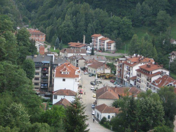
Crna Trava (Serbian Cyrillic: Црна Трава, [t͡sr̩̂ːnaː trǎːʋa]) is a village and municipality located in the Jablanica District of the southern Serbia. According to 2011 census, the population of the village is 452 inhabitants, while population of the municipality is 1,661. This is the poorest municipality in the country.
Contents
- Serbia open crna trava 2013 jedan krug po stazi
- Map of Crna Trava Serbia
- Name
- Demographics
- Ethnic groups
- References
Map of Crna Trava, Serbia
Name
The name of the village in Serbian translates to Black Grass. The origin of the name dates back to 1389, when Battle of Kosovo took place. A Serbian army unit, composed of Serbian archers and cavaliers, decided to take a rest on a grass field while travelling to the battlefield. Since the flowers and other herbs covering the field were highly poisonous, the soldiers became intoxicated, thereby they did not wake up on time for the battle. Realizing that fact, they cursed the grass that poisoned them, branding it "black" grass.
Demographics
Crna Trava, along with the rest of Vlasina region, suffers from heavy depopulation, chiefly for economic reasons. According to the 2011 census results, the municipality of Crna Trava has a population of 1,663 inhabitants.
Ethnic groups
Ethnic composition of the municipality: