
Population 1,978 (2011 census) Postal code 2090 | Postcode(s) 2090 | |
 | ||
Location 6 km (4 mi) north of Sydney CBD | ||
Cremorne point manor sydney australia
Cremorne Point is a harbourside suburb on the lower North Shore of Sydney, New South Wales, Australia. Cremorne is located 6 kilometres north of the Sydney central business district, in the local government areas of North Sydney Council.
Contents
- Cremorne point manor sydney australia
- Map of Cremorne Point NSW 2090 Australia
- 2 116 milson road cremorne point 2090 new south wales
- Etymology and history
- Demographics
- Transport
- References
Map of Cremorne Point NSW 2090, Australia
Cremorne Point shares the postcode of 2090 with Cremorne, a separate suburb to the north. Cremorne Point sits on Sydney Harbour between Shell Cove and Mosman Bay. Cremorne Junction is a locality within the suburb of Cremorne.
2 116 milson road cremorne point 2090 new south wales
Etymology and history
Cremorne was named after the Cremorne Gardens in London, a popular pleasure ground in England, which derives from Gaelic words meaning 'boundary' and 'chieftain'. Robertsons Point was named after James Robertson who was granted 35 hectares there in 1820. He was the father of Premier Sir John Robertson.
James Milson Jnr (1814-1903), son of James Milson (1785-1872) who had owned much land in nearby Milsons Point, was a merchant and a pastoralist in NSW and Queensland. In time he greatly expanded the family's land holdings in the lower North Shore, including the 1853 purchase of the Cremorne peninsula. The sale of this land for residential blocks in the last years of the 19th and early years of the 20th centuries proved to be especially profitable. Much to Milson's disgust, the courts prevented him from selling building blocks running right to the water's edge and Cremorne is consequently one of the few Sydney Harbour peninsulas with a public, waterfront park running around its edges. The last of the family's holdings in the lower North Shore area were resumed in the early 1920s for the construction of the Harbour Bridge and associated roadways.
Demographics
According to the 2011 census, there were 1,978 residents in Cremorne Point. Of these:
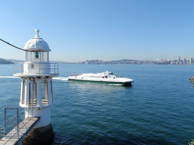
Transport
Cremorne Point ferry wharf is served by Mosman Bay services located on the peninsula's south-west. It was partially sunk in storms on 9 June 2007 and operational again on 15 September 2007.
At the 2011 census, 31.7% of employed people travelled to work on public transport and 44.8% by car (either as driver or as passenger).