
Population 155 (2011 Census) Civil parish Crawley Dialling code 01993 | OS grid reference SP3412 Sovereign state United Kingdom | |
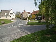 | ||
Crawley is a village and civil parish beside the River Windrush about 2 1⁄2 miles (4 km) north of Witney, Oxfordshire. The parish extends from the Windrush in the south almost to village of Leafield in the northwest. The 2011 Census recorded the parish's population as 155.
Contents
Map of Crawley, Witney, UK
Archaeology
There is a pair of Bronze Age bowl barrows just south of Blindwell Wood, about 1 3⁄4 miles (2.8 km) north of the village. They may be date from 2400 to 1500 BC. They are a scheduled monument.
The course of Akeman Street, a major Roman road, passes through the parish about 1 1⁄4 miles (2 km) north of the village.
In 1964 a 13th-century medieval iron arrowhead was found in the Windrush at Crawley.
History
Uphill Farmhouse was built in the 17th century.
Crawley's chapel of Saint Peter was built in 1837 as a chapel of ease for the Church of England parish church at Hailey, Oxfordshire. It has ceased to be used for worship and has been converted into a private house.
Crawley village is above a sharp bend on the Windrush. The present road bridge across the river is probably late 18th-century.
Crawley Mill on the Windrush was part of the Witney area's former blanket-making industry. It has a mill stream and was originally water-powered but was later converted to steam power. It is now an industrial estate.
Amenities
Crawley has two public houses: the 17th-century Lamb Inn and the Crawley Inn.