
Elevation 283 m | ||
 | ||
Similar Gathland State Park, South Mountain, Fox's Gap, National War Correspo, Washington Monument State Park | ||
Ultimate general civil war part 16 push on crampton s gap
Crampton's Gap, also known as Crampton Gap, is a wind gap on South Mountain in Maryland.
Contents
- Ultimate general civil war part 16 push on crampton s gap
- Map of Cramptons Gap 22 Burkittsville MD 21769 USA
- Bloody assault of crampton s gap union campaign 17 ultimate general civil war
- References
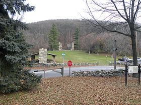
Map of Crampton's Gap, 22, Burkittsville, MD 21769, USA
The 928 feet (283 m) gap connects Burkittsville in the Middletown Valley to the east with Gapland and Rohrersville in the Pleasant Valley to the west.
The gap is the location of Gathland State Park and was the site of the Battle of Crampton's Gap on September 14, 1862, during the Maryland Campaign of the American Civil War.
Bloody assault of crampton s gap union campaign 17 ultimate general civil war
References
Crampton's Gap Wikipedia(Text) CC BY-SA