
Population 14,081 Post town COWDENBEATH Local time Tuesday 6:10 PM Dialling code 01383 | OS grid reference NT160916 Sovereign state United Kingdom Postcode district KY4 8, KY4 9 Scottish parliament Cowdenbeath | |
 | ||
Weather 6°C, Wind S at 14 km/h, 79% Humidity | ||
Road trips in scotland cowdenbeath fife
Cowdenbeath (/ˌkaʊdənˈbiːθ/; Scots: Coudenbeith) is a town and burgh in west Fife, Scotland. It is 5 miles north-east of Dunfermline and 18 miles north of the capital, Edinburgh. The town grew up around the extensive coalfields of the area and became a Police Burgh in 1890. According to a 2008 estimate, the town has a population of 14,081.
Contents
- Road trips in scotland cowdenbeath fife
- Map of Cowdenbeath UK
- Drive from cowdenbeath kinross perthshire scotland
- Toponymy
- History
- Geography
- Demography
- References
Map of Cowdenbeath, UK
The wider civil parish of Beith has a population of 17,351 (in 2011).
Drive from cowdenbeath kinross perthshire scotland
Toponymy
The first element of the town's name comes from the surname Colden or Cowden, often indicated in early forms as a possessor by the addition of -(i)s, for example Cowdennyes Baith. Beath, the name of the wider parish, is from the Gaelic beith, meaning birch.
History
The earliest indication of human activity in the immediate vicinity of the current site of Cowdenbeath was provided by the discovery of late Bronze Age vessels containing incinerated human remains, in 1928. An article by eminent archaeologist A.D. Lacaille F.S.A Scot details the find of a late bronze-age cemetery near Tollie Hill. One of the urns found contained fragments of processed Arran pitchstone, indicating some economic activity and commerce.
There is no evidence of a permanent settlement establishing itself around the current site of Cowdenbeath until the designation of the original Beath Kirk as a parish church in 1429/30 to act as a focal point to serve the surrounding area. The earliest written record of Beath (Beth) was found in a charter of Inchcolm Abbey, dated 6 March 1178. This charter makes reference to the Chapel of Beth. Although it is generally accepted that the word beath in Gaelic means ’birch’, P.W. Brown suggests that the word means ‘abode’ or ‘a settlement.’ In 1643 the Reverend John Row of Carnock, a leading opponent of episcopacy, was instrumental in establishing the Parish of Beath as an entity in its own right by separating it from the parish of Dalgety Bay and Aberdour. This significant date followed the building of a new church in 1640 at Beath, to replace the ruins of a sanctuary, which had fallen into sad disrepair. The present church, visible today, was constructed in 1834–35 by James MacFarlane and was altered in 1884–86.
It is alleged that the infamous graverobbers Burke and Hare sourced some of their cadavers from Beath Cemetery, to supply to the Scottish surgeon Dr. Robert Knox for dissection. Precautions were taken at Beath Cemetery to prevent body-snatching and for many years what were taken to be two iron coffins without lids dug up from the old churchyard lay near the old hearse house. These were not actually coffins, but old-time safes that were placed over the coffin to hinder the work of the body-snatchers. Another preventative measure adopted was the placing of a large flat stone on top of the grave. This stone was very heavy and was placed on the grave and removed by means of a trestle hoist, the rope going through the stone and fastened on the underside, and it remained there until the danger of "snatching" was past. The two "safes" have since disappeared, but the flat stone is still to be seen near the church. The Blaeu Map of Fife, published in 1654 by eminent 17th-century Dutch cartographer Joan Blaeu, refers to Cowden Beth in the current vicinity of Cowdenbeath.
When the actual name of Cowdenbeath came into being is not known, but it is thought to have originated when turnpike roads were first made and that it marked the spot of an inn and later of a tollhouse erected in the 17th century.
By 1790 the records show that the parish of Beath had about 100 families whose livelihood came mainly from the soil. The fact that Beath Church served a very large area led to the creation of many "kirke roads", roads that form rights-of-way even today. This church was replaced by the present church, built in 1832 and enlarged in 1886.
Cowdenbeath first came into prominence around 1820 as a stop on the north-bound coaching route to Perth. Indeed, Queen Victoria's entourage stopped at the Cowdenbeath Coaching Inn to change horses on her first trip to Scotland in 1842, en route for Balmoral. The coaching inn, the Old Inn, was established at the junction of roads from North Queensferry, Perth, Dunfermline and Burntisland. When the new turnpike road from Queensferry to Perth was constructed, the inn gained more importance.
Before 1850, Cowdenbeath was just a collection of farms within the parish of Beath. The area was divided into four districts named after local farms: Kirkford, Foulford, White Threshes and Cowdenbeath farm, close to the present-day site of Central Park. Local inhabitants of these focal points of growth, which were merging into a single town, met to decide on a name for the emerging town. The eventual decision was narrowed down to either White Threshes or Cowdenbeath and Cowdenbeath was the chosen name. The arrival of the Oakley Iron Company around 1850 was to have a long-lasting impact upon Cowdenbeath and make the name synonymous with coal-mining for almost 100 years. Shafts were sunk in the vicinity of the old Foulford Washer. It was in the mining for ore that the discoveries of the coal seams were made, and pits were sunk at every corner of the town. Before this, coal had been mined at Fordell for over a century, but the discovery of the coal seams at the depth they were found came as a pleasant surprise, considering the dip in the coal strata at Fordell, as it was previously thought that the seams at Cowdenbeath would be at such a depth as to be almost unworkable.
By 1850, the flourishing coal pits of Kelty, Lochgelly, Donibristle, Fordell and Hill of Beath surrounded the hamlet of Cowdenbeath. Within the greater area, which later became the Burgh of Cowdenbeath, there was little mining activity. Gibson, of Hill of Beath and the Symes, of Cartmore, had opened small pits in the vicinity of Jubilee Park at the southern border of the Burgh, and other small pits appear to have been worked in the vicinity of Union Street. However, the situation was about to change when (contrary to earlier speculation) the Oakley Iron Company proved the area was rich in iron and coal. The opening of the Dunfermline–Thornton railway, via Cowdenbeath, in 1848, enhanced the prospects for mining and pits were sunk in every corner of the area, primarily for ironstone but, when this became uneconomic around the late 1870s, for coal alone.
The Forth Iron Company took over the Oakley Iron Company around 1860 then amalgamated with the Cowdenbeath Coal Company in 1872. When the Fife Coal Company subsequently took them over in 1896, the Cowdenbeath Coal Company's pits were listed as: Lumphinnans Nos. 1, 2, 7, 11; Cowdenbeath Nos. 3, 7, 9; Foulford No. 1 and Mossbeath. This effectively made the Fife Coal Company one of the largest coal-ining concerns in Scotland. Such was the upsurge in mining activity that the population of Cowdenbeath doubled (4,000–8,000) in the ten years between 1890 and 1900 and gave rise to the nickname "Chicago of Fife". This was a significant increase on the 1820 figure of 120.
Such was the extent of the importance of Cowdenbeath to coal mining at the turn of the century (circa 1900) that several institutions essential to mining became established there. The headquarters of the Fife and Kinross Miners' Association were opened in Victoria Street on 8 October 1910, and the first mine rescue station opened at Cowdenbeath on 4 November 1910 on Stenhouse Street, opposite Beath High School. The Central Works, Cowdenbeath, (commonly referred to as "The Workshops") were built in 1924 by the Fife Coal Company Limited in order to centralise its supervisory staff and to cope with the greater amount of manufacturing and maintenance work caused by the intensive mechanisation programme which was being introduced in its mines.
Another significant mining-related building, which reflected Cowdenbeath's growing status at the forefront of mining technology, was the establishment of the Fife Mining School in 1895. The school had humble origins, operating out of two rooms in Broad Street School, until it was transferred to the basement of Beath High School on Stenhouse Street. It was not until 1936 that Fife Mining School acquired its own custom-built building on the site of the old Woodside House on Broad Street. The new Fife Mining School was erected at a cost of £22,500, and was opened on 22 March by Mr Ernest Brown, MP, then Parliamentary Secretary to the Mines Department. The school trained apprentices in all aspects of the mining trade; however, it did have a temporary change of use during both world wars, when it was used to train women working in the munitions industry. The mining school closed in 1976, reflecting the diminishing role of coal mining in the community.
Geography
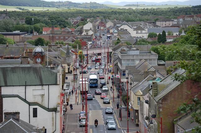
Cowdenbeath lies in south-western Fife, near the larger town of Dunfermline. Its precise coordinates are 56.11°N 3.35°W. The town lies in a low, undulating, arable landscape to the south east of the Ochil Hills. Whilst for the main part Cowdenbeath is fairly level, significant portions of the town have succumbed to subsidence as a result of the network of mine shafts and tunnels underlying the town.
Notably, photographs of Cowdenbeath High Street circa 1900 published in Stenlake Publications show a flat High Street in which it is possible to view its entire length from north to south under the overarching railway bridge. This is impossible today, as the subsidence on the High Street has been so great that the railway bridge now obscures the view from one end to the other.
The south and eastern boundaries of Cowdenbeath are circumscribed by the A92 main road to Kirkcaldy, and beyond that the peat-bog and petrochemical plant of Mossmorran.
The western perimeter of Cowdenbeath merges into the neighbouring village of Hill of Beath, and is bound by the natural landscape of the gentle slopes of the hill itself, and by Loch Fitty. The proximity of the M90 motorway to the south of Cowdenbeath, and to a lesser extent to the east, also serves to define its lower boundary.
The northern boundary of Cowdenbeath is characterised by a rural landscape, which merges into the Lochore Meadows Country Park ("The Meadies"). This formerly industrial/mining landscape, which was host to a number of pit-heads (including the Mary Pit, whose winding gear structure dominates the park as a monument to its mining legacy), is now a very picturesque area which provides leisure and recreational outdoor amenities.
Demography
According to the United Kingdom Census 2011, the census locality of Cowdenbeath had a total resident population of 14,081, an increase of 21% on the 2001 census figure of 11,627. The proportional split of males to females at 48.5% to 51.5% is consistent with the proportional split by gender in both the Fife and Scottish populations.