
Type Public, state Created 2013 Area 32.37 km² | Open All year Phone +1 541-394-0002 | |
 | ||
Similar Maryhill State Park, Goldenda Observat State Park, Cottonwo Bridge, Dufur RV Park, Le Page Park | ||
Cottonwood Canyon State Park, established in 2013, is the second largest state park in Oregon, encompassing 8,000 acres (3,200 ha) on the lower John Day River. The largest is Silver Falls State Park at 9,064 acres (3,668 ha).
Contents
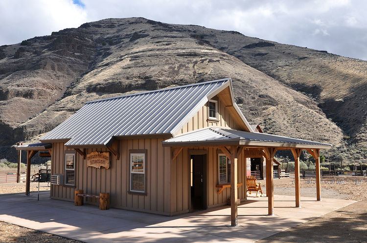
Park headquarters, about a two-hour drive east of Portland, is adjacent to Oregon Route 206 between Wasco and Condon. The river, which here forms the boundary between Sherman County on the west and Gilliam County on the east, meanders for 16 miles (26 km) through the arid park.
The walls of the main canyon reach to 1,920 feet (590 m) above sea level within the park, which also includes four side canyons: Hay Creek, Esau, Rattlesnake, and Cottonwood. These and the main canyon are flanked by grassland, sagebrush shrub-steppe, river bottom, and cliffs composed mainly of basalts of the Columbia River Basalt Group.
Grant s getaways cottonwood canyon state park
History
In 2008, the Western Rivers Conservancy, a non-profit organization based in Portland, bought the land from a cattle-ranching family, the Murthas, who had owned it since the 1930s. The conservancy was able to borrow money from the Wyss Foundation to make a quick purchase possible. Later, Western Rivers offered to sell the land to the Oregon Parks and Recreation Department (OPRD) to create a state park. OPRD agreed and paid Western Rivers what the non-profit had paid the Murthas, $7.86 million.
Recreation
Hiking, camping, fishing, and river rafting are among the recreation possibilities in the park. A campground with 21 primitive sites, 7 sites for hikers and bikers, a group camping area, potable water, and a restroom are near the park headquarters and the information building. Hiking trails include Pinnacles, in Sherman County, and Lost Corral, in Gilliam County, each of which follows the river downstream for 4.3 miles (6.9 km). On the upstream side of the highway, the Hard Stone Trail follows the river for 1.5 miles (2.4 km). In addition, old ranching roads that cross the park double as hiking trails, and an adjacent 10,000 acres (4,000 ha) of public land managed by the U.S. Bureau of Land Management offer further possibilities for hiking.
Horse trails wind through the Gilliam County segment of the park. The J. S. Burres day-use area, also in the Gilliam County segment, is a put-in place for boaters heading downriver and a take-out place for commercial and private groups running the John Day between Clarno and Route 206. Hunting, subject to Oregon Department of Fish and Wildlife regulations, is allowed in undeveloped parts of the park.
Fauna and flora
The largest herd of California bighorn sheep live in the area, as do Rocky Mountain elk, mule deer, pronghorn, coyotes, and many smaller mammals. A variety of snakes, including the western rattlesnake, live in the park, which is also home to several lizard species. Frogs, toads, and waterfowl can be found near the river. Fish in the river include Chinook salmon, steelhead, catfish, carp and smallmouth bass.
Raptors such as American kestrels and Swainson's hawks frequent the area. Game birds such as the chukar partridge and the ring-necked pheasant are found in the uplands, and migratory birds such as Bullock's oriole and the lazuli bunting visit the park in summer.
Balsamroot and monkey flower bloom here in early May. Sagebrush blooms in October. OPRD workers have been planting small numbers of box elder, chokecherry and hawthorn trees to provide shade near park headquarters.