
 | ||
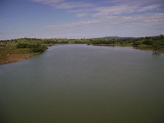
The Corumbá River (Rio Corumbá in Portuguese) is the most important river in the Central Plateau region of Brazil. Its source is in the Montes de Pireneus, near Pirenópolis, state of Goiás, near the boundary with the Federal District and its length ifs 567 km. It receives the waters of the Descoberto and São Bartolomeu, which begin in the Federal District. There are plans to build a hydroelectric plant on this section of the river.
Map of Corumb%C3%A1 River, State of Goi%C3%A1s, Brazil
The Corumbá flows south from its source near Corumbá de Goiás, where there are spectacular waterfalls, is crossed by a major ridge on the Brasília-Goiânia highway east of Alexânia, passing near Pires do Rio and Caldas Novas, south of which it enters the Itumbiara Reservoir, the lake damming up the Paranaíba River, one of the main tributaries of the Paraná.
Near Caldas Novas the Corumbá is dammed and forms a large reservoir called Corumbá Lake.
The Corumbá receives untreated sewage from several cities in Goiás. Its banks suffer the consequences of removal of sand and gravel in several points (in Luziânia sand was removed to build Brasília). The loss of the natural forest and agricultural activity are responsible for negative impact on all the course of the river.