
Country United States FIPS code 31-10635 Elevation 440 m Zip code 68331 Local time Monday 2:47 PM | Time zone Central (CST) (UTC-6) GNIS feature ID 0828355 Area 67 ha Population 472 (2013) Area code 402 | |
 | ||
Weather 24°C, Wind SW at 48 km/h, 28% Humidity | ||
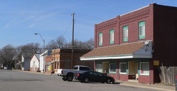
Cortland is a village in Gage County, Nebraska, United States. The population was 482 at the 2010 census.
Contents
Map of Cortland, NE 68331, USA
History
Cortland was platted in 1884 when the railroad was extended to that point. It was named after the city of Cortland, New York.
Geography
Cortland is located at 40°30′25″N 96°42′25″W (40.507005, -96.706841).
According to the United States Census Bureau, the village has a total area of 0.26 square miles (0.67 km2), all of it land.
2010 census
As of the census of 2010, there were 482 people, 204 households, and 138 families residing in the village. The population density was 1,853.8 inhabitants per square mile (715.8/km2). There were 219 housing units at an average density of 842.3 per square mile (325.2/km2). The racial makeup of the village was 98.8% White, 0.6% Native American, 0.2% Asian, and 0.4% from two or more races. Hispanic or Latino of any race were 0.2% of the population.
There were 204 households of which 31.4% had children under the age of 18 living with them, 59.3% were married couples living together, 6.4% had a female householder with no husband present, 2.0% had a male householder with no wife present, and 32.4% were non-families. 24.5% of all households were made up of individuals and 12.2% had someone living alone who was 65 years of age or older. The average household size was 2.36 and the average family size was 2.83.
The median age in the village was 40.4 years. 24.1% of residents were under the age of 18; 4.3% were between the ages of 18 and 24; 30.5% were from 25 to 44; 23% were from 45 to 64; and 18% were 65 years of age or older. The gender makeup of the village was 50.8% male and 49.2% female.
2000 census
As of the census of 2000, there were 488 people, 198 households, and 149 families residing in the village. The population density was 1,911.2 people per square mile (724.7/km²). There were 209 housing units at an average density of 818.5 per square mile (310.4/km²). The racial makeup of the village was 98.77% White, 0.20% Asian, and 1.02% from two or more races. Hispanic or Latino of any race were 0.41% of the population.
There were 198 households out of which 34.8% had children under the age of 18 living with them, 65.7% were married couples living together, 8.1% had a female householder with no husband present, and 24.7% were non-families. 21.7% of all households were made up of individuals and 7.6% had someone living alone who was 65 years of age or older. The average household size was 2.46 and the average family size was 2.89.
In the village, the population was spread out with 25.8% under the age of 18, 7.2% from 18 to 24, 30.1% from 25 to 44, 21.5% from 45 to 64, and 15.4% who were 65 years of age or older. The median age was 37 years. For every 100 females there were 105.9 males. For every 100 females age 18 and over, there were 96.7 males.
As of 2000 the median income for a household in the village was $40,694, and the median income for a family was $47,000. Males had a median income of $31,583 versus $23,000 for females. The per capita income for the village was $17,053. About 2.7% of families and 4.3% of the population were below the poverty line, including 3.6% of those under age 18 and 5.8% of those age 65 or over.