
- left Browns Canyon Wash - elevation 62 ft (19 m) | - elevation 1,831 ft (558 m) | |
 | ||
- location Northeast of Watsonville, California | ||
Corralitos Creek is a 14.1-mile-long (22.7 km) southward-flowing stream originating on the western slope of the Santa Cruz Mountains in Santa Cruz County, California, United States. It courses through the communities of Corralitos and Freedom, and touches the northernmost part of Watsonville before joining Salsipuedes Creek. Salsipuedes Creek is the lowermost tributary of the Pajaro River, which carries its waters to Monterey Bay and the Pacific Ocean.
Contents
- Map of Corralitos Creek California USA
- HistoryEdit
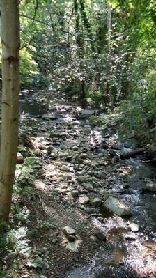
- Watershed and courseEdit
- Habitat and wildlifeEdit
- References
Map of Corralitos Creek, California, USA
HistoryEdit
On Sunday, October 15, 1769, the Portola expedition's route took them northwestward across today's Corralitos Creek and through a redwood forest. They stopped to camp near a lagoon in the middle of a narrow valley which Father Crespi named Santa Teresa. They left this place in the morning by a northwest course, following the narrow valley where there were many extremely large redwood trees. The lagoon was named Laguna de las Calabasas but is now referred to as Corralitos Lagoon. The lagoon is located on the Rancho Los Corralitos very near its boundary with the Calabasas Rancho just west of Freedom Boulevard and is not part of the Corralitos Creek mainstem. Rancho Los Corralitos was a Mexican land grant given to José Amesti, a Basque immigrant in 1823. "Los Corralitos" means "the little corrals" in Spanish. The small town of Amesti, California still bears his name.
Watershed and courseEdit
The Corralitos and Salsipuedes Creeks sub-basins are the lowest tributaries of the Pajaro River. Browns Creek is the largest tributary of Corralitos Creek although many small gulches draining the southwestern Santa Cruz Mountains also contribute. Casserly Creek flows through now dry College Lake (originally named Laguna Grande) before emptying into Corralitos Creek. Near East Lake Avenue, Corralitos Creek joins the much shorter Salsipuedes Creek, the latter draining Kelly Lake.
Habitat and wildlifeEdit
The upper watershed of Corralitos Creek and its Browns Creek tributary is designated "high potential" habitat for steelhead trout (Oncorhynchus mykiss) and is a top priority stream for the protection and restoration of the South-Central California Coast Distinct Population Segment (DPS) of this anadromous fish. The valleys of the upper watershed are dominated by coast redwood (Sequoia sempervirens).