
Elevation 595 m (1,952 ft) Time zone CET (UTC+1) Local time Monday 10:49 AM Postal code 55025 Dialling code 0583 | Demonym(s) Coreglini Area 52.8 km² | |
 | ||
Frazioni Calavorno, Ghivizzano, Gromignana, Lucignana, Piano di Coreglia, Tereglio, Vitiana Weather 12°C, Wind SW at 16 km/h, 85% Humidity | ||
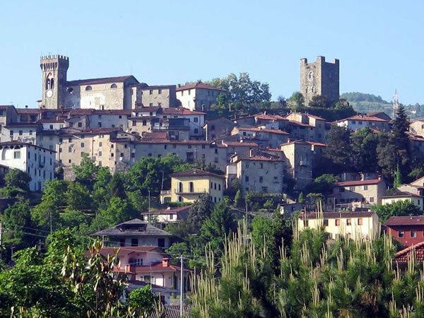
Coreglia Antelminelli is a comune (municipality) in the Province of Lucca in the Italian region Tuscany, located about 70 kilometres (43 mi) northwest of Florence and about 25 kilometres (16 mi) north of Lucca.
Contents
- Map of 55025 Coreglia Antelminelli Province of Lucca Italy
- Monuments and places of interest
- Ethnic groups and foreign minorities
- References
Map of 55025 Coreglia Antelminelli Province of Lucca, Italy
Coreglia Antelminelli borders the following municipalities: Abetone, Bagni di Lucca, Barga, Borgo a Mozzano, Fiumalbo, Gallicano, Pievepelago.
Monuments and places of interest
Ethnic groups and foreign minorities
According to ISTAT data on December 31, 2010 the foreign population was 371 people. The nationalities most represented according to their percentage of the total resident population were:
References
Coreglia Antelminelli Wikipedia(Text) CC BY-SA