
13/31 3,800 Code CRO Phone +1 559-992-2141 | Elevation AMSL 197 ft / 60 m 3,800 1,158 Address Corcoran, CA 93212, USA Elevation 60 m Owner Lakeland Dusters Aviation | |
 | ||
Airport type Public / PERMANENTLY CLOSED Similar J G Boswell Co, Mefford Field | ||
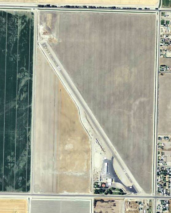
Corcoran Airport (IATA: CRO, ICAO: KCRO, FAA LID: CRO) is a public use airport located two nautical miles (3.7 km) west of the central business district of Corcoran, a town in Kings County, California, United States. It is privately owned by Lakeland Dusters, Inc. The airport has been permanently closed.
Contents
Facilities and aircraft
Corcoran Airport covers an area of 220 acres (89 ha) at an elevation of 197 feet (60 m) above mean sea level. It has one asphalt paved runway designated 13/31 which measures 3,800 by 50 feet (1,158 x 15 m). For the 12-month period ending October 3, 2007, the airport had 5,600 aircraft operations, an average of 15 per day, all of which were general aviation. At that time there were 18 aircraft based at this airport: 61% single-engine, 28% jet and 11% helicopter.
World War II
During World War II, the airport was used an auxiliary training airfield for Lemoore Army Airfield, California.