
Type Reservoir Surface area 11 km (4.2 sq mi) Area 11 km² | Primary inflows Islands Coquitlam Island Surface elevation 154 m | |
 | ||
Similar | ||
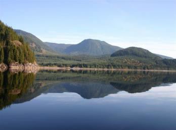
Coquitlam lake coquitlam bc mar 2016
Coquitlam Lake is a reservoir located just north of Coquitlam, British Columbia. It is one of the three main water sources for Metro Vancouver, and part of the Coquitlam watershed. It is also a part of BC Hydro's power generation system. A tunnel directs water from the lake to nearby Buntzen Lake, and from there to a pair of power stations.
Contents
- Coquitlam lake coquitlam bc mar 2016
- Map of Coquitlam Lake Greater Vancouver A BC Canada
- HistoryEdit
- References
Map of Coquitlam Lake, Greater Vancouver A, BC, Canada
HistoryEdit
Construction of the tunnel between Coquitlam Lake and Buntzen Lake began in 1902 and finished in 1905, supplying water to powerhouses on Indian Arm, which supplied electricity to Vancouver.
The first Coquitlam Dam, built to raise the water level by 5 feet (1.52 m), was begun in April 1904 and completed in 1905. It was built to protect the water supply to the powerhouses, and also supplied water to New Westminster. By 1906 the original dam was discovered to be leaking, and while repairs were made the leak continued through 1908, until the current dam was completed in 1914.