
Primary inflows Basin countries United States Max depth 21 m Mean depth 7 m | Type Reservoir, eutrophic Primary outflows Cooper Creek Area 67 ha Surface elevation 205 m Shore length 8.2 km | |
 | ||
Catchment area 4.5 square miles (12 km) | ||
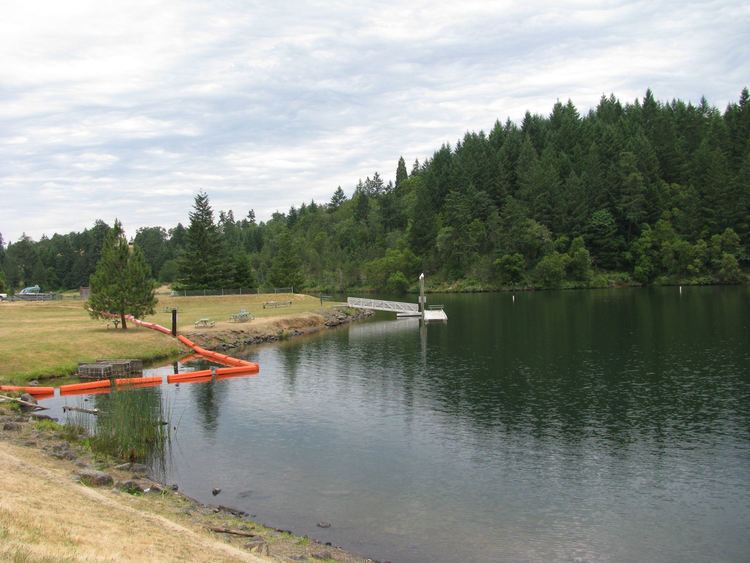
Cooper Creek Reservoir is a body of water behind an earthen dam across Cooper Creek in the Umpqua River basin of the U.S. state of Oregon. The reservoir is in Douglas County, about 2 miles (3 km) east of Sutherlin and about 11 miles (18 km) north of Roseburg. The impoundment provides part of Sutherlin's drinking water.
Contents
Map of Cooper Creek Reservoir, Oregon 97479, USA
The reservoir supports populations of largemouth bass, panfish, and stocked rainbow trout. The panfish and bass grow to large sizes, but mercury pollution from old mine tailings upstream makes eating them risky. In 2001, the Oregon Department of Human Services issued a mercury-related health advisory for fish caught in the reservoir. However, municipal water from the reservoir was deemed safe to drink, and the mercury posed no threat to recreational activities in the lake. Mercury levels in the fish were not expected to diminish in the foreseeable future.
RecreationEdit
Cooper Creek Reservoir Park, managed by Douglas County, has two boat launches, a swimming area, and a dock. It offers opportunities for fishing, waterskiing, and jet skiing. Amenities include a pavilion, a picnic area, and toilets. The park is for day use only, and no camping is allowed. A hiking trail circles the reservoir.