Samiksha Jaiswal (Editor)

Conodoguinet Creek

Updated on
Edit
Like
Comment
Share on FacebookTweet on TwitterShare on LinkedInShare on Reddit
Length
  
167 km

Conodoguinet Creek Conodoguinet Creek Water Trail

Bridges
  
Ramp Covered Bridge, Horse Valley Bridge

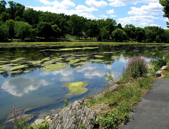
Conodoguinet creek middlesex pa


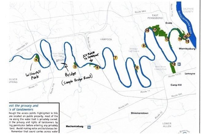
Conodoguinet Creek is a 104-mile-long (167 km) tributary of the Susquehanna River in South central Pennsylvania in the United States. The name is Native American, and means "A Long Way with Many Bends".

Contents

Conodoguinet Creek Conodoguinet Creek PA Eastern Fly Fishing

Conodoguinet Creek joins the Susquehanna River upstream of Harrisburg.

The water divide between Conodoguinet Creek and Conococheague Creek is sometimes used as the boundary between the Hagerstown Valley and the Cumberland Valley. It flows past many mills, including Maclay's Mill. The Appalachian Trail crosses the creek near Carlisle.

Conodoguinet Creek Conodoguinet Creek Kayaking Camping and Other Hobbies

Conodoguinet creek watershed association volunteer cleanup june 2016


BridgesEdit

Conodoguinet Creek Watershed Wednesday Conodoguinet Creek Watershed Association

  • The Ramp Covered Bridge crosses Conodoguinet Creek at Hopewell Township in Cumberland County, Pennsylvania.
  • There were formerly four more wooden covered bridges over the creek, but two were destroyed by storms ("Good Hope Mill" and "Watts Bridge") and the other three ("Erb's," "Orr's," and "Oyster Mill") were replaced by modern concrete bridges after they became so old as to be unreliable. Watts Bridge, near Creekside, the home of Frederick Watts, was also replaced by a concrete structure in the 1980s-90s; the Good Hope Mill bridge was never replaced after its destruction.

  • Conodoguinet Creek National Weather Service Advanced Hydrologic Prediction Service

    Conodoguinet Creek httpsuploadwikimediaorgwikipediacommonsthu

    Conodoguinet Creek Conodoguinet Creek Water Trail

    References

    Conodoguinet Creek Wikipedia


    Similar Topics