
Length 8.0 mi (12.9 km) | Maintained by NYCDOT | |
 | ||
Other name(s) Conduit BoulevardNorth / South Conduit Avenue Part of NY 27 from Lindenwood to Rosedale | ||
muninyc cohancy street north conduit avenue ozone park queens 11417
Conduit Avenue (Conduit Boulevard in Brooklyn) is an arterial road in New York City, the vast majority of which is in Queens. The divided highway runs from Atlantic Avenue in Cypress Hills, Brooklyn to Hook Creek Boulevard in Rosedale, Queens at the Nassau County border. The thoroughfare is named after an aqueduct in its right-of-way. Conduit Avenue and Conduit Boulevard were conceived in 1921 as part of the Conduit Highway, later the Sunrise Highway, with the original highway opening in 1929. The highway was expanded in 1940 as part of the construction of Belt Parkway.
Contents
- muninyc cohancy street north conduit avenue ozone park queens 11417
- Map of Conduit Blvd Brooklyn NY 11208 USA
- Etymology
- Route
- History
- References
Map of Conduit Blvd, Brooklyn, NY 11208, USA
Etymology
Conduit Avenue and Conduit Boulevard are named for the conduit of the Brooklyn Water Works which fed Ridgewood Reservoir and were constructed on the former right-of-way of the aqueduct. The conduit was known as the Ridgewood Aqueduct.
Route
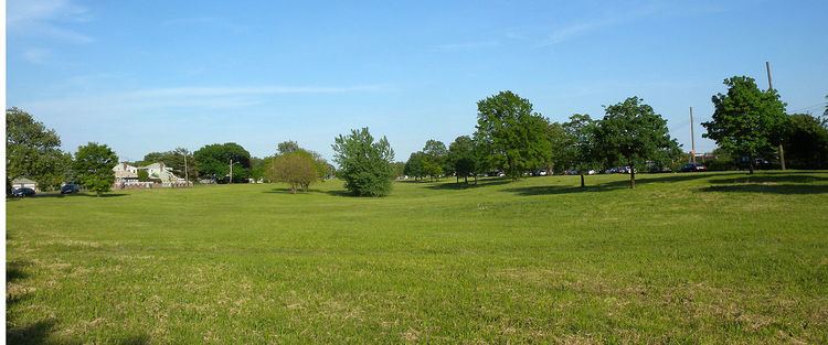
West of Cross Bay Boulevard, Conduit Boulevard has a wide median strip and runs adjacent to a number of parks with playgrounds. It is one of the few divided roads in Brooklyn with a grass median and serves as the boundary between the neighborhoods of Cypress Hills and City Line in Brooklyn and Ozone Park and Lindenwood in Queens. Between the Shore Parkway and the Laurelton Parkway, Conduit Avenue serves as the service road for Southern Parkway. East of Brookville Boulevard, South Conduit Avenue parallels the Montauk Branch of the Long Island Rail Road and continues as Sunrise Highway in Valley Stream. At 225th Street, North Conduit Avenue goes to the north to Hook Creek Boulevard, with the Sunrise Highway merging into it to the south.
Conduit Avenue is designated as New York State Route 27 between Linden Boulevard and the Nassau County border and accommodates car, bus and truck traffic. Westbound vehicles use the roadway named North Conduit Avenue; eastbound vehicles use South Conduit Avenue. At various times the road has been used as a drag strip, particularly in Rosedale.
The western segment of the highway, between Atlantic Avenue and Cross Bay Boulevard, was originally slated to be the eastern part of a planned, but never built, Bushwick Expressway. That highway was proposed to run from the Williamsburg Bridge through Williamsburg, Bushwick and East New York before feeding into the Belt Parkway.
History
The original Brooklyn Waterworks brick conduit stretched from Long Island to the Ridgewood Pumping Station, now the site of City Line Park, in East New York. There, the water was pushed via a steam-powered pump north through a "force tube" into the Ridgewood Reservoir; the route of this tube is now Force Tube Avenue. The reservoir was opened in 1858, and the pumping station in 1886. The aqueduct was located on the north side of what is now Conduit Avenue, and was built on an undeveloped right-of-way. When the City of Brooklyn was consolidated as a borough of New York City in 1898, New York City gained possession of the Brooklyn Waterworks' assets, including the reservoir and its 25-mile (40 km) long aqueduct stretching to Massapequa in Nassau County. At this time, the right-of-way was still largely undeveloped, with the conduits located underground. Both Force Tube Avenue and Conduit Avenue were laid out and paved by the 1910s.
Plans to construct a highway along the conduit path emerged in 1914. In 1921, the New York State Legislature signed a bill to construct a highway along the right-of-way known as Conduit Highway, ending in Amityville. The route included both Conduit Avenue and the Sunrise Highway. The original plans called for a grade-separated parkway, but the route was later designed to be 30 feet (9.1 m) to 40 feet (12 m) wide. The highway was planned to relieve congestion on Merrick Road/Merrick Boulevard. Construction began on the highway in 1924 or 1925. In conjunction with the project, what was then Linden Avenue was extended east from Kings Highway to Conduit Boulevard, becoming Linden Boulevard. The highway was referred to by various names including Conduit Boulevard and Pipe Line Boulevard. By 1928, the entire stretch from Brooklyn to Amityville was officially named the Sunrise Highway, following efforts by the Long Island Chamber of Commerce. The label Conduit was deemed "an unattractive one and quite meaningless." The Sunrise Highway name, meanwhile, was reference to the nickname for Long Island, "Land of the Sunrise Trails". The entire highway was opened on June 9, 1929. An inauguration ceremony was held at Liberty Avenue in Brooklyn. In 1931, the city planned to extend Conduit Boulevard north to Jamaica Avenue along Force Tube Avenue, which would require condemning property along the avenue in order to widen it, but this never took place.
In the early 1930s, it was proposed to convert the Conduit Boulevard route between Linden Boulevard and Laurelton Boulevard/Brookville Boulevard into a state parkway, with North and South Conduit Avenues created as service roads for the parkway. The purpose of the project was to create express highway links between Brooklyn and Long Island, via Linden Boulevard, Sunrise Highway, and the Southern State Parkway. The original 1931 plans, known as the Southern State Parkway extension, called for an arterial road adjacent to the existing narrow Sunrise Highway. Later plans called for a parkway. As early as July 1934, land was acquired via eminent domain to widen Conduit Boulevard and build the new parkway. The project would become the Southern Parkway section of the Belt Parkway, which would connect to the Belt system's Laurelton Parkway at Brookville Bouelvard and feed into the Southern State Parkway. In justifying the conversion of the Conduit route into part of the Belt system, NYC Parks commissioner Robert Moses cited the "approximately 10,00,000 cars" traveling the route on an annual basis, and the need for a highway link between Brooklyn and Long Island to create "the ultimate cirumferential boulevard."
North and South Conduit Avenue were constructed as service roads along with the Southern Parkway. Shortly after the opening of the Belt Parkway system in 1940, Conduit Boulevard west of the parkawy was expanded into a six-lane highway, with the right-of-way widened to create the grassy median. The project was completed around 1942, in conjunction with the widening of Atlantic Avenue and grade separation of the LIRR Atlantic Branch.