
Population 216 Civil parish Compton Abbas Local time Saturday 6:18 AM Number of airports 1 | OS grid reference ST869184 Sovereign state United Kingdom Dialling code 01747 | |
 | ||
Weather 4°C, Wind S at 8 km/h, 97% Humidity | ||
Day trip to compton abbas
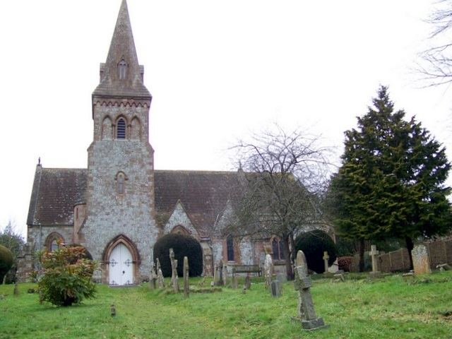
Compton Abbas is a village and civil parish in the county of Dorset in southern England. It lies within the North Dorset administrative district, 3 miles (4.8 km) south of the town of Shaftesbury. It is sited on greensand strata on the edge of the Blackmore Vale, below the chalk downs of Cranborne Chase. On top of these hills is Compton Abbas Airfield. The A350 road between Wiltshire and the south coast passes through the village. In the 2011 census the civil parish had a population of 216. The name Compton Abbas derives from the Saxon "cumb-ton", meaning 'village in a narrow valley', plus "abbas" which refers to Shaftesbury Abbey (the land was owned by the abbess). The church, St. Mary's, was built in 1866 to replace the older structure which was more remote from the village.
Contents
- Day trip to compton abbas
- Map of Compton Abbas UK
- Dorset shaftesbury compton abbas st876187 20080224
- References
Map of Compton Abbas, UK
The tower of the Church of St Mary in East Compton is a Grade I listed building.