
 | ||
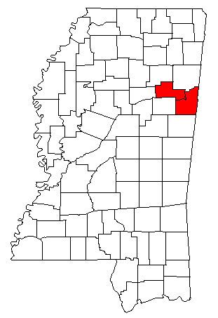
The Columbus-West Point, MS Combined Statistical Area was formerly defined as consisting of Clay and Lowndes counties in northeastern Mississippi, which were separately treated as the West Point Micropolitan Statistical Area and Columbus Micropolitan Statistical Area, respectively. As of the 2000 census, the CSA had a population of 83,565. A July 1, 2009 estimate placed the population at 80,380.
Contents
The metropolitan area delineations published by the Office of Management and Budget in February 2013 no longer include Clay County as a micropolitan statistical area and they no longer treat the two counties as a combined statistical area.
Incorporated places
Unincorporated places
Demographics
As of the census of 2000, there were 83,565 people, 31,001 households, and 22,290 families residing within the CSA. The racial makeup of the CSA was 52.88% White, 45.44% African American, 0.14% Native American, 0.44% Asian, 0.02% Pacific Islander, 0.34% from other races, and 0.74% from two or more races. Hispanic or Latino of any race were 1.05% of the population.
The median income for a household in the CSA was $29,748, and the median income for a family was $36,855. Males had a median income of $30,915 versus $20,057 for females. The per capita income for the CSA was $15,513.