
Length 65.7 km | ||
 | ||
Counties | ||
State Highway 61 (SH 61) is a 40.8-mile (65.7 km) state highway in northeastern Colorado.
Contents
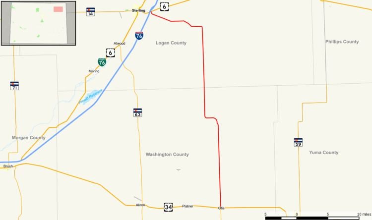
Map of CO-61, Colorado, USA
Route description
SH 61 begins at an at-grade intersection with U.S. Highway 34 at the south side of Otis. It begins straight northward through town, in which roads are laid out in a grid-like pattern. The road then exits the town, entering sparsely populated wilderness. Near the Washington - Logan county line, the road abruptly turns westward and eastward again, crossing the boundary a few miles later. It then again turns abruptly westward, this time to meet its north end at Interstate 76 concurrent with U.S. Highway 6 east of Sterling.
History
The road was established in the 1920s, when it connected U.S. Highway 36 near Cope to US 38 (former) near Sterling. When U.S. Highway 38 was moved around 1930, the terminus was redefined as SH 154, which took its place. The section from its current terminus at Otis to US 36 was deleted and the northern terminus was adjusted to U.S. Highway 6, which later became Interstate 76, in 1954. The route was entirely paved three years later.