
Length 178.7 km | ||
 | ||
Counties | ||
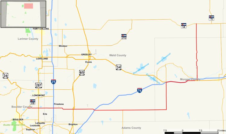
State Highway 52 (SH 52) is a 111 mi (178.6 km) long state highway in northeastern Colorado.
Contents
Map of State Hwy 52, Colorado, USA
Route description
SH 52 begins near Niwot, running east from its western terminus past US 287 to a diamond interchange with I-25, near the towns of Dacono, Frederick, and Firestone. The highway continues east through interchanges with US 85 in Fort Lupton and I-76 in Hudson. Farther east, the route bends north about 12 miles (19 km) south of Wiggins where it begins its concurrency with I-76, US 6, and US 34 eastward to Fort Morgan where it again turns north and traverses to Raymer, where it ends at SH 14.
References
Colorado State Highway 52 Wikipedia(Text) CC BY-SA