
Counties: Garfield | Length 18.34 km | |
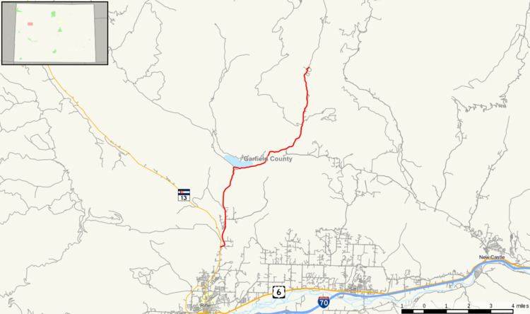 | ||
State Highway 325 is a highway connecting two state parks near Rifle, Colorado.
Contents
Map of CO-325, Rifle, CO 81650, USA
Route description
SH 325 runs 11.4 miles (18.3 km), starting at a junction with SH 13 north of Rifle. The highway goes north to Rifle Gap State Park. From there it follows East Rifle Creek east and then north to Rifle Falls State Park. After passing the falls it continues north along the creek, ending at the entrance to Rifle Mountain Park.
Major intersections
The entire route is in Garfield County.
References
Colorado State Highway 325 Wikipedia(Text) CC BY-SA