
Length 18.53 km | ||
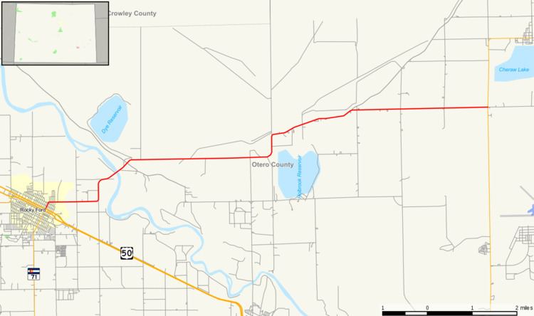 | ||
State Highway 266 is a highway near Rocky Ford, Colorado.
Contents
Map of CO-266, Rocky Ford, CO 81067, USA
Route description
SH 266 runs 11.5 miles (18.5 km), starting at a junction with US 50 in Rocky Ford. The highway goes east, crosses the Arkansas River and ends at a junction with SH 109 near Cheraw.
Major intersections
The entire route is in Otero County.
References
Colorado State Highway 266 Wikipedia(Text) CC BY-SA