
Counties: El Paso | Length 5.018 km | |
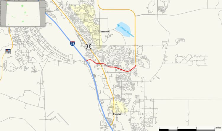 | ||
State Highway 16 is a short east–west expressway in El Paso County, south of Colorado Springs. Highway 16 constitutes the westernmost portion of a longer road known as the Mesa Ridge Parkway.
Contents
Map of CO-16, Fountain, CO, USA
The eastern and western termini of this highway are both in the city of Fountain. However, part of the route passes through an unincorporated area of El Paso County.
Route description
SH 16 begins with an interchange at I-25, which also provides access to Frontage Road. From here, it heads southeast, crosses Fountain Creek, and intersects US 85. From there, it extends east several miles eastward and ends at SH 21, known there as Powers Boulevard.
History
The route was established in 1971 from I-25 east to US 85, totaling about one mile. It was gradually extended until 2007, when Mesa Ridge Parkway was added to the route, and the route length almost tripled.
Major intersections
The entire route is in Fountain, El Paso County.