
Length 36.75 km | ||
 | ||
East end: US 285 / SH 17 south of Alamosa Counties | ||
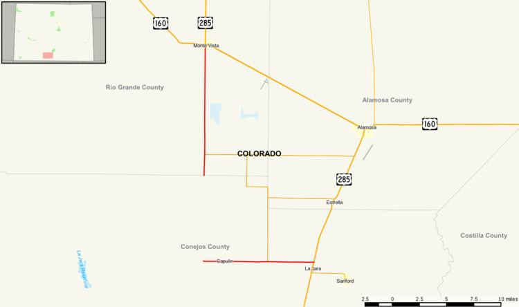
State Highway 15 in the U.S. state of Colorado is a north–south, east–west state highway in the San Luis Valley region of Southern Colorado. It connects the two towns of Monte Vista and Alamosa. There is a gap in the route.
Contents
Map of Co Hwy 15, Harts, WV 25524, USA
Route description
The route begins at a concurrency between US 285 and US 160. After about 12 miles, at the Rio Grande-Conejos county line, there exists an eight-mile gap filled in by Conejos County Route 6. After the gap, SH 15 reappears, crosses over the La Jara Creek, and ends at US 285 south of Alamosa.
History
The route was established in the 1920s as a much longer route, but it was gradually cut down to its current length. The route was paved in 1957.
References
Colorado State Highway 15 Wikipedia(Text) CC BY-SA