
Length 43.5 km | ||
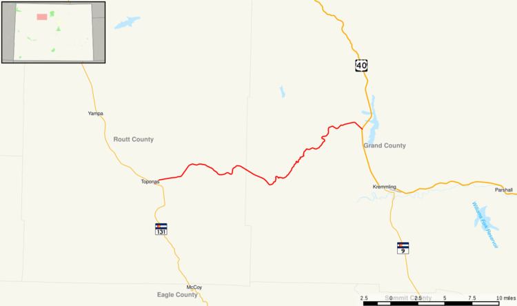 | ||
State Highway 134 is a 27 mi (43.5 km) long state highway in northern Colorado.
Contents
Map of CO-134, Colorado, USA
Route description
SH 134 begins in the west at Toponas and proceeds eastward entering Routt National Forest after three miles (5 km). From there the road climbs gradually for roughly thirteen miles to an elevation of 9,527 ft (2,904 m) at Gore Pass. At Gore Pass the route moves into Arapaho National Forest through which it passes for roughly three miles before leaving National Forest Service land. SH 134 continues for approximately eight more miles to its eastern terminus at U.S. Highway 40 six miles (10 km) north of Kremmling.
History
The routing was originally part of the route SH 84. Then, after the U.S. Routes were established, to avoid confusion with U.S. Highway 84, the route was renumbered to SH 134 in 1968. There have been no major routing changes since SH 84 was established.