
 | ||
Similar Monte Amiata, Maremma, Abbey of San Galgano, Parco naturalistico delle Bia, Valdichiana | ||
Colline metallifere
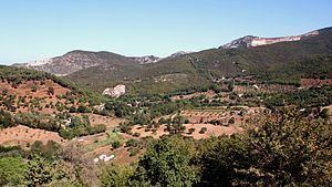
The Colline Metallifere ([kolˈliːne metalˈliːfere], "Metal-bearing Hills") are a mountain-hill group in the Tuscan Antiapennine, in central Italy. They occupy the central-western part of Tuscany, divided between the provinces of Livorno, Pisa, Siena and Grosseto.
Contents
- Colline metallifere
- Map of Colline Metallifere 53030 Radicondoli Province of Siena Italy
- 2 rally delle colline metallifere crash show
- Province of LivornoEdit
- Province of PisaEdit
- Province of SienaEdit
- Province of GrossetoEdit
- References
Map of Colline Metallifere, 53030 Radicondoli, Province of Siena, Italy
The territory, with the exception of the Poggio di Montieri and Cornate di Gerfalco peaks, both above the 1,000 m, is mostly hilly, with a rich variety of minerary resources, whence the name. It also includes geothermic energy sources, part of which used in ENEL power plants at Larderello and Lago Boracifero. Rivers include the Cecina, the Cornia and the Merse.
The metal resources of the Colline Metallifere were exploited since ancient times by the Etruscans: production reached its peak in the mid-19th century, declining quickly however afterwards. The numerous railways serving the mills are now mostly suppressed.