
Elevation 140 m (460 ft) Area 23.85 km² Population 2,550 (31 Dec 2008) | Time zone CET/CEST (UTC+1/+2) Local time Thursday 3:23 AM Administrative region Lower Franconia | |
 | ||
Weather 9°C, Wind W at 13 km/h, 97% Humidity | ||
Collenberg is a community in the Miltenberg district in the Regierungsbezirk of Lower Franconia (Unterfranken) in Bavaria, Germany. It has a population of about 2,400.
Contents
- Map of Collenberg Germany
- Location
- Subdivisions
- History
- Community council
- Coat of arms
- Attractions
- Transport
- Education
- References
Map of Collenberg, Germany
Location
Collenberg lies on right bank of the Main, 13 km away from Miltenberg and 18 km from Wertheim. Along the Main between Collenberg and Freudenberg runs the boundary between Bavaria and Baden-Württemberg. Behind Collenberg lie the wooded hills of the Spessart.
Subdivisions
Collenberg’s Ortsteile are Fechenbach, Reistenhausen and Kirschfurt.
History
The community came into being in 1971 in the framework of municipal reform in Bavaria with the merger of the former communities of Fechenbach, Kirschfurt and Reistenhausen.
Community council
The council is made up of 14 council members, with the seats apportioned thus:
Coat of arms
The community’s arms might be described thus: A fess wavy argent, in chief gules, dexter a wheel spoked of six and sinister a dog’s head erased gorged sable with studs of the first, in base azure three maces, two and one, issuant palewise from the base.
The three maces come from the arms once borne by the Schenken of Klingenberg, former overlords who gave the castle its name after the founder of their line, whose name was Kolbo (and in German, the word for “mace” is Streitkolbe, or simply Kolbe), and are thus a canting charge. The wheel in the escutcheon’s upper half on the dexter (armsbearer’s right, viewer’s left) side is the Wheel of Mainz, and refers to the area’s long rule by Electoral Mainz, lasting until the Holy Roman Empire was at last dissolved in 1803. The dog’s head on the sinister (armsbearer’s left, viewer’s right) side is another canting charge. Although the usual word for “dog” in German is Hund, there is also the word Rüde, and thus this dog’s head refers to the noble family of Rüdt von Collenberg. The wavy fesse symbolizes the local river, the Main.
The arms have been borne since 1973.
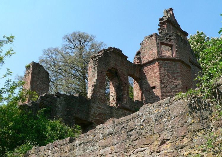
Attractions
Transport
On the other side of the Main runs Staatsstraße (State Road) 2310, which is linked in Kirschfurt with Collenberg's main road. This road leads east along the right bank of the Main to Hasloch.