
Traversed by D912 Elevation 1,134 m | ||
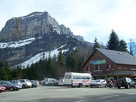 | ||
Col du Granier (el. 1,134 m.) is a mountain pass in the Alps in the department of Savoie in France which crosses the Chartreuse Mountains to connect the villages of Entremont-le-Vieux (south), Apremont (north) and Chapareillan (east). It has been traversed several times by the Tour de France cycle race, including on Stage 12 of the 2012 race. It is situated between Mont Granier (1,933 m) (south-east) and Mont Joigny (1,558 m) (north-west).
Contents
- Map of Col du Granier 73190 Apremont France
- Details of the climbs
- Appearances in Tour de France
- References
Map of Col du Granier, 73190 Apremont, France
Details of the climbs
From the north, the climb starts at Chambéry, from where there are 15.3 km.of climbing, gaining 864 m. in height at an average of 5.6%.
From Chapareillan (east), the climb (via the D285) is 9.7 km. long, gaining 845 m. at an average of 8.6%, with a maximum of 17.9%.
From St-Pierre-d'Entremont (south), the climb is 9.4 km. at an average of 5.3%, gaining 494m. in height.
Appearances in Tour de France
The pass was first included in the Tour de France in 1947 and has since featured 17 times and is generally ranked as a Category 1 or 2 climb. It was crossed most recently on Stage 12 of the 2012 tour, between Saint-Jean-de-Maurienne and Annonay-Davézieux, approaching from the direction of Chapareillan.