
Traversed by D431 Elevation 1,343 m | Range Vosges | |
 | ||
Similar Vosges, Col Amic, Grand Ballon, Col du Platzerwasel, Col du Hundsruck | ||
Team wielerflits op col du grand ballon
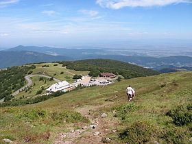
The Col du Grand Ballon (elevation 1,343 m (4,406 ft)) is a mountain pass situated close to the summit of the Grand Ballon (1,424 m (4,672 ft)) in the Vosges Mountains of France. It connects Cernay (Haut-Rhin) with Le Markstein winter sports station.
Contents
- Team wielerflits op col du grand ballon
- Map of Col du Grand Ballon 68360 Murbach France
- Details of the climbs
- Tour de France
- Amateur cycling
- References
Map of Col du Grand Ballon, 68360 Murbach, France
Details of the climbs
There are several different directions from which the Col du Grand Ballon can be climbed:
From Cernay (south-east), the total distance is 23.3 km (14.5 mi) at an average gradient of 4.5%, gaining 1,046 m (3,432 ft) in height. This route follows the Route des Crêtes over the Col de Herrenfluh (835 m (2,740 ft)) after 9.5 km (5.9 mi). After a short descent, the road climbs again to the Col de Silberloch (906 m (2,972 ft)) before descending to the Col Amic (828 m (2,717 ft)). From here, there remain 6.8 km (4.2 mi) at an average of 7.6%. In the forest on this final section, there are two short paved stretches. 3 km (1.9 mi) from the summit, the gradient increases to over 8%.
From Willer-sur-Thur (south), the ascent (via D138) is 16.0 km (9.9 mi) long, climbing 974 m (3,196 ft) at an average of 6.1%. This route joins that from Cernay at the Col Amic.
From the south it is also possible to climb on minor roads from Saint-Amarin or Moosch, both on the N66; these routes join together at Geishouse. Both routes are approximately 12.5 km (7.8 mi) long at an average of over 7%, with a kilometre section near the summit at 12%.
From Soultz (east), the route follows a minor road for the first 12.0 km (7.5 mi) at a steady average gradient of 4.6%, before joining the other routes at Col Amic. In total, the climb is 19.0 km (11.8 mi) long, climbing 1,072 m (3,517 ft) at an average of 5.6%.
From Kruth (west), the climb (via D27) is 22.9 km (14.2 mi) long gaining 853 m in height at an average of 3.7%. This climb joins the D431 at Le Markstein.
Tour de France
The Tour de France first crossed over the Col du Grand Ballon in 1969, when the leader over the summit was Lucien Van Impe. It has been crossed on a further six occasions, the most recent in 2014.
Amateur cycling
The Col du Grand Ballon is also used by amateur cyclists on the "Trois Ballons" sportive ride held in June (together with the climbs over the Ballon d'Alsace and the Ballon de Servance).