
Traversed by D1075 Elevation 1,179 m | Range Alps | |
 | ||
Similar Alps, Mont Aiguille, Grande Tête de l'Obiou, Col Bayard, Grand Veymont | ||
Scenic drive e712 col de la croix haute france
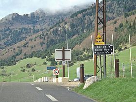
Col de la Croix-Haute (el. 1179 m.) is a high mountain pass in the French Dauphiné Alps on the border of the Isère and Drôme departments, linking the towns of Clelles and Mens in the North with Lus-la-Croix-Haute in the South.
Contents
- Scenic drive e712 col de la croix haute france
- Map of Col de la Croix Haute 38930 Lalley France
- Sv105833 avi col de la croix haute mars 2010
- References
Map of Col de la Croix-Haute, 38930 Lalley, France
Sv105833 avi col de la croix haute mars 2010
References
Col de la Croix Haute Wikipedia(Text) CC BY-SA