
- right Swindlers Creek Length 55 km | - elevation 1,400 m (4,593 ft) - elevation 694 m (2,277 ft) | |
 | ||
Mouths | ||
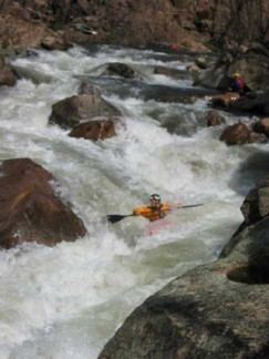
Fly fishing for trout on the cobungra river victoria australia
The Cobungra River, a perennial river of the North-East Murray catchment of the Murray-Darling basin, is located in the East Gippsland and alpine regions of Victoria, Australia.
Contents
- Fly fishing for trout on the cobungra river victoria australia
- Map of Cobungra River Victoria Australia
- Cobungra river
- Location and features
- References
Map of Cobungra River, Victoria, Australia
Cobungra river
Location and features
The Cobungra River rises below the slopes of the ski resort at Mount Hotham and Mount Loch and flows generally east and then north, joined by two tributaries including the Victoria River. At its confluence with the Big River in the Alpine National Park, near Anglers Rest on the Omeo Highway, the two rivers become the Mitta Mitta River, itself a tributary of the Murray River. The Cobungra River descends 743 metres (2,438 ft) over its 55-kilometre (34 mi) course.
The current historical Omeo Highway bridge at Anglers Rest stands on the site of the former river ford known as Jack's Crossing, named for an overseer at the nearby Mount Wills station who drowned while leading a team of packhorses across the flooded river in 1856.
The Cobungra River is particularly noted as being good for trout fishing, in particular brown trout. It was one of just thirteen locations worldwide featured on the fly fishing documentary television series A River Somewhere.