
Local time Wednesday 11:41 AM | ||
 | ||
Weather 11°C, Wind S at 18 km/h, 73% Humidity | ||
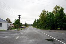
Coalgate is a locality in the Selwyn District of the Canterbury region of New Zealand's South Island. The 2001 New Zealand Census of Population and Dwellings gave Coalgate's population as 276, and it is located roughly an hour west of Christchurch on State Highway 77. The town's name stems from it being the "gateway" to the lignite coal fields around Whitecliffs, the Rakaia Gorge, and Acheron River. Coal mining declined in the 20th century and has now ceased, but since the 1950s, commercial processing of bentonite has taken place in Coalgate.
Map of Coalgate, New Zealand
On 3 November 1875, the Whitecliffs Branch railway was opened, with a station in Coalgate. It was here that a private line diverged from the state-operated New Zealand Railways Department network. On 31 March 1962, the railway closed, but some of the line's old formation and the Coalgate station platform can still be found.
Notable features are the Coalgate Tavern and the Coalgate Cabins, both situated on the main road to Hororata. Coalgate also has a walkway through the old Coalgate Domain. In addition to these there is also a Coalgate Bowling green. The town has access to the Selwyn river and is closely situated to Glentunnel.