
- elevation 1,275 ft (389 m) Length 40 km Source Island Pond Cities Newport | - elevation 682 ft (208 m) Basin area 378.1 km² Country United States of America | |
 | ||
- left (from the mouth) Toad Pound discharge, Buck Brook, Mad Brook, Cold Brook, Payne Brook. - location Newport (city), Vermont, Orleans County, Vermont, United States Mouths Newport, Lake Memphremagog Similar Northern Forest Canoe Tr, Echo Lake, Lamoille River, Brighton State Park, Lake Willoughby | ||
The Clyde River is a tributary of Lake Memphremagog, over 33.5 miles (54 km) long, in northern Vermont in the United States. It is the easternmost of the four major rivers in Orleans County. It is the most powerful of the four within Orleans County, powering several turbines at damsites. It is part of the Northern Forest Canoe Trail.
Contents
- Map of Clyde River Vermont USA
- GeographyEdit
- CourseEdit
- CharlestonEdit
- DerbyEdit
- Natural historyEdit
- GeologyEdit
- ToponymyEdit
- DamsEdit
- TributariesEdit
- List of cities and townsEdit
- References
Map of Clyde River, Vermont, USA
It was named by one of the early surveyors from his partiality to a river of the same name in Scotland.
The Route 105/114 junction to Clyde Road section of Clyde River in Vermont is 21 miles (34 km) long and is rated by American Whitewater as a class I-III section.
GeographyEdit
It drains the water from about 146 square miles (378 km2). With the exception of three miles (5 km) of rapids near its mouth, this is a very sluggish stream, passing through in its course, several natural ponds of considerable size. Even during spring high water, there is barely a perceptible current.
CourseEdit
The river has its source in Spectacle Pond (length: 1.4 kilometres or 0.87 miles; altitude: 357 metres or 1,171 feet) in Brighton. The Southern part of Spectacle Pond is part of Brighton State Park. Spectacle Pond is actually a kettle. It is only 8 to 10 feet (2.4 to 3.0 m) deep with a thick bottom of muck.
From the mouth of Spectacle Pond, the Clyde river flows on 53.9 kilometres (33.5 mi) as follows:
Higher course of the river (segment of 4.9 kilometres (3.0 mi))
Pherrins River which is the main tributary of Clyde River, empties into the Clyde River from the north at 0.9 kilometres (0.56 mi) below the outlet, frequently rises quite suddenly, swelling the waters of the latter so as to reverse its current and cause it to back up into Island Pond with great force for ten hours or more, until the pond is full, or the water subsides below, when it will again change and rush out.
Intermediary course of the river(segment of 26.6 kilometres (16.5 mi))
From the mouth of Pherrins River, the Clyde River flow as follow:
Lower course of the river (segment of 22.4 kilometres (13.9 mi))
CharlestonEdit
The Clyde River is the largest in Charleston. It runs nearly through the center of the town. Some falls of importance are found on the stream, especially the Great Falls in the western part of the town, where the descent is more than 100 feet (30 m) in 66 feet (20 m); but its current is generally slow.
DerbyEdit
The Clyde River forms the principal water-course, flowing through the town from east to west.
After exiting from Clyde Pond #1, it proceeds westward. It empties into Lake Salem from the south. It exits the northwest corner of this lake. It is then joined by an unnamed brook from Derby Pond from the north. It then empties into Clyde Pond #2 from the northeast. It exits this Pond west and into south Lake Memphremagog from the north. The mouth is just east of where US 5/Vermont 105 crosses Lake Memphremagog.
Natural historyEdit
Beaver populate the countryside and sometimes undercut the streamside silver maple, toppling them into the water thereby creating logjams.
The river winds through farm country, with silver maple and alder dominating the shoreline. Northern white cedar, an occasional willow, and a variety of shrubs line the 40-foot (12 m) wide waterway, and vegetation dips right into the water.
GeologyEdit
The river is in the Nulhegan Basin of northeastern Vermont.
ToponymyEdit
The term "Clyde" is a popular first name with English origin. This term is also used as surname.
This toponym was officialized on October 29, 1980 at Geographic Names Information System (GNIS) of US federal government.
DamsEdit
In the early 19th century a mill dam constructed at Arnolds Falls. In 1883 a dam was constructed at the outlet to Lake Memphremagog. In 1918 the Newport Dam (Clyde Pond #2) was constructed. This dam was also known as Prouty Dam (after Governor Prouty). It was 713 feet (217 m) long. This was also known as the Clyde Pond dam.
The Echo Lake dam is used for hydroelectric power. Construction was completed in 1922. It has a normal surface area of 530 acres (2.1 km2). It is owned by Citizens Utilities Company. The dam is concrete. The core is homogeneous concrete. The foundation is rock. The height is 16 by 120 feet (4.9 by 36.6 m). Maximum discharge is 693 cubic feet (19.6 m3) per second. Its capacity is 5,000 acre feet (6,200,000 m3). Normal storage is 3,180 acre feet (3,920,000 m3). It drains an area of 24 square miles (62 km2).
In 1928 a dam was constructed at West Charleston. In 1929 a dam was built at Pensioner's Pond.
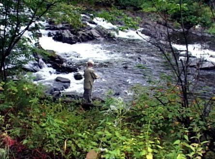
In 1957 #11 Dam was constructed. It was located 1,000 feet (305 m) below the current hydro generation station off Clyde Street. In 1994 the #11 Dam was breached. In 1996 the #11 Dam was removed. In 2007 a fish (salmon) passage was built at the Newport Dam. Salmon fishing in Lake Memphremagog and the Clyde nearly stopped when the dam was constructed. It has improved since the dam's removal. The State of Vermont stocks the river with 30,000 salmon annually. 6,000 perish immediately from predators. Of those that make the journey to Lake Memphremagog, 18,000 return to spawn. The remainder assumed to be caught by fishermen.
TributariesEdit
The following dams are on tributaries (watershed) that feed into the Clyde, and not the Clyde itself:
Lake Seymour is on a tributary which drains into Echo Lake, which in turn drains into the Clyde. It is used for hydroelectric power. Construction was completed in 1928. It has a normal surface area of 2.8 square miles (7.3 km2). It is owned by Citizens Utilities Company. This dam is stone, and concrete. The core is concrete. The foundation is soil. Its height is 7 feet (2.1 m) by 68 feet (21 m) long. Maximum discharge is 85 cubic feet (2.4 m3) per second. The capacity is 5,200 acre feet (6,400,000 m3). Normal storage is 3,500 acre feet (4,300,000 m3). It drains an area of 20.1875 square miles (52.285 km2).
List of cities and townsEdit
In upstream order: