
Time zone CST (UTC-6) Area 90.44 km² Population 938 (2010) | Established November 4, 1856 Elevation 228 m Local time Tuesday 9:41 AM | |
 | ||
ZIP codes 61238, 61262, 61413, 61414, 61490 Weather 6°C, Wind SW at 34 km/h, 56% Humidity | ||
Clover Township is one of twenty-four townships in Henry County, Illinois, USA. As of the 2010 census, its population was 938 and it contained 428 housing units. Clover Township was originally known as Ashnelet Township, but was changed on an unknown date.
Contents
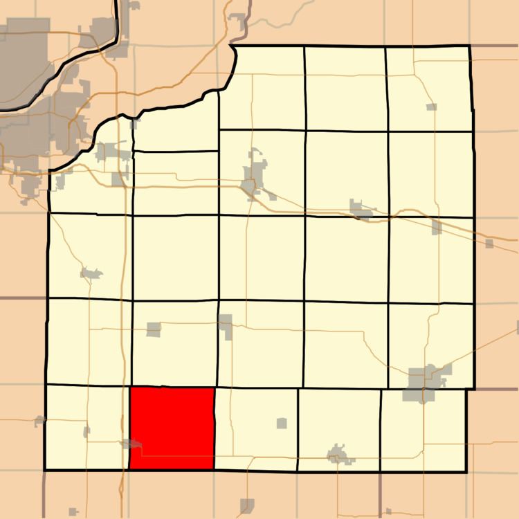
- Map of Clover Township IL USA
- Geography
- Cities towns villages
- Adjacent townships
- Cemeteries
- Major highways
- School districts
- Political districts
- References
Map of Clover Township, IL, USA
Geography
According to the 2010 census, the township has a total area of 34.92 square miles (90.4 km2), all land.
Cities, towns, villages
Adjacent townships
Cemeteries
The township contains these two cemeteries: Clover Chapel and Woodhull.
Major highways
School districts
Political districts
References
Clover Township, Henry County, Illinois Wikipedia(Text) CC BY-SA