
Population 0 (2011 census) Postcode(s) 5152 Postal code 5152 | Established 2001 Time zone ACST (UTC+9:30) Founded 2001 | |
 | ||
Location 10 km (6 mi) east of Adelaide city centre | ||
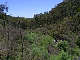
Cleland is a suburb in South Australia located in the Adelaide metropolitan area about 10 kilometres (6.2 mi) south-east of the Adelaide city centre. Its boundaries were created in October 2001, with additional land being added in 2010 from the adjoining suburb of Crafers. Its name is derived from the Cleland Conservation Park. The principal land use within the locality is conservation with the majority of its land area being occupied by the Cleland Conservation Park. Places within its extent include the summit of Mount Lofty. Cleland is located within the federal Division of Mayo, the state electoral district of Bragg and the local government area of the Adelaide Hills Council.
Map of Cleland SA 5152, Australia
References
Cleland, South Australia Wikipedia(Text) CC BY-SA