
Population 4,725 (2011.Ward) Sovereign state United Kingdom Local time Monday 10:35 PM | OS grid reference SD745315 Post town ACCRINGTON Dialling code 01254 | |
 | ||
Weather 5°C, Wind W at 14 km/h, 94% Humidity | ||
Clayton le moors body find
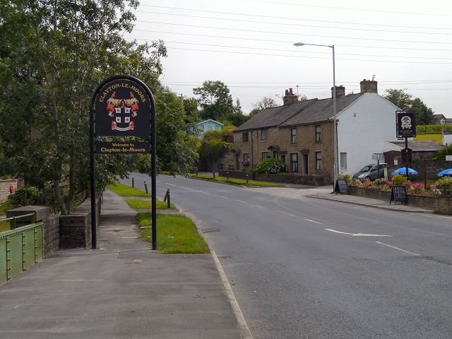
Clayton-le-Moors is a small industrial township two miles north of Accrington in the Borough of Hyndburn in the County of Lancashire, England. It is usually referred to locally as simply 'Clayton'. There is also a ward with the same name in Hyndburn. The population of this ward at the 2011 census was 4,725. To the west lies Rishton, to the north Great Harwood, and two miles to the south, Accrington. Clayton-le-Moors is situated on the A680 road alongside the M65 motorway.
Contents
- Clayton le moors body find
- Map of Clayton le Moors Accrington UK
- Clayton le moors riley
- History
- Governance
- Sport
- Schools
- Pubs
- Hotels
- Notable People
- Notable Businesses
- References
Map of Clayton-le-Moors, Accrington, UK
Clayton le moors riley
History
It is thought that the village developed with the fusion of the two hamlets of Oakenshaw (bottom end) and Enfield (top end) which began during the construction of the Leeds Liverpool Canal, which pre-dated the railways. The merger continued with the development of the cotton textile industry, particularly that of weaving and cloth finishing. The stretch of canal between Burnley and Enfield Wharf (now alongside the Enfield Bridge on Blackburn Road) was opened in 1801. By 1808 it had been extended to the adjoining village of Church. The final link up between Leeds and Liverpool was completed 1816. Clayton-le-Moors now lies at the mid point of the Leeds Liverpool Canal. Sadly, the mural which depicted this fact has been demolished. The canal continued to be used for the commercial transportation of coal between Bank Hall Colliery, Burnley and the now demolished power generating station at Whitebirk, Blackburn, until 1963. During the harsh winter of 1963 the thickness of the ice on the canal prevented the movement of barges and coal had to be transported by road. Subsequently, canal transportation was never resumed. The canal is now used solely for leisure boating and is managed and maintained by a charitable trust, the Canal and River Trust.
The village's two main thoroughfares are Whalley Road, which still has some canal workers' cottages, and Blackburn Road to the West/Burnley Road to the East.
Mercer Park, once the grounds of Mercer House, is freely open to the public, and contains an updated war memorial. The house was previously Oakenshaw Cottage, where John Mercer lived towards the end of his life. Mercer, a self-taught chemist born in Great Harwood, invented the mercerisation process for treating cotton which is still in use today. He was also a pioneer of colour photography.
Clayton-le-Moors is said to be a village of two halves. Residents were either 'top-enders' or 'bottom-enders', depending on which side of the Whalley Road canal bridge they lived. The two communities had firm opinions about each other and were said to rarely mix. With the mixing of the town's children at common schools, this is no longer the case but the distinction between top and bottom enders still remains. There was, however, an annual football match between them at the running track at Wilson's Playing Fields (formerly the Woodlands Playing Fields), which lie behind woodland close to Sparth House in lower Whalley Road. The synthetic running track there is surrounded by football pitches, a cricket pitch and changing rooms.
In 1987 during house building in the area, builders stumbled upon mass adult & child graves around Pickup Street, Sparth Road and Barnes Square. Upon further inspection and a 14 week excavation of the area, they found over 1000 skeletal remains thought to date back to the sixteen hundreds.
Governance
Clayton-le-Moors was once a township in the ancient parish of Whalley, with Dunkenhalgh in the south-west and Hyndburn Brook forming the boundary with Rishton and Great Harwood as far as the River Calder. This became a civil parish in 1866. Between 1894 and 1974 the area was administered by an Urban District Council. As a consequence of the re-organisation of Local Government in 1974, Clayton became an unparished constituent of the Borough of Hyndburn, centered on Accrington.
Sport
Clayton Le Moors Harriers founded in 1922, is one of the largest athletic clubs in the North of England, catering for cross-country, fell and road running.
Kuon Ji Ju Jitsu Association is a martial arts club established in October 1982, by Sensei Tony Gregson under the guidance of Sensei Thomas Duckett it meets at the Civic Library on Pickup Street.
Hyndburn athletics club is the biggest track and field club in the area and is a successful club winning midlands championships back to back also has many Lancashire champions, combined event champions, English school competitors and competitors for Lancashire.
Enfield Cricket Club is the town's cricket club and competes in the Lancashire League.
Schools
Secondary education is no longer available within the town. 11 - 18 year olds now have to travel to schools in adjoining Hyndburn townships or beyond. Three primary schools provide education for the under 11s. They are Mount Pleasant Primary School on Earl Street, All Saints Church of England Primary School on Church Street and St Marys Roman Catholic Primary School on Devonshire Drive.
Pubs
There are a few pubs: The Albion, Hare and Hounds, Hyndburn Bridge, Forts Arms, The Royal Oak, Old England Forever, Wellington Hotel, Sparth Manor - built at an unknown date but sold for the first time in 1556, and the Conservative Club. There were three Working Men's Clubs, known colloquially as the Top, Middle and Bottom Clubs. The Top Club closed in the 2000s and became an eating house. The Come and Welcome was the Middle Club and no longer functions, but the Bottom Club – Park View – remains open. Perhaps its most famous pub was The Load O' Mischief, which was well known throughout Lancashire. It was situated by the traffic lights at the junction of the A678 and A670 trunk roads and gave its name to the 4 bus stops adjacent to its location in Whalley Road, Blackburn Road and Burnley Road for the routes to Accrington-Clayton Forts Arms and Blackburn- Burnley. Although the Load O' Mischief was closed and demolished to make way for the M65 motorway in the late 1970s, its name is still used to refer to the area around the traffic lights at the Whalley Road, Blackburn and Burnley Roads Junction.
Hotels
Hotels include the Dunkenhalgh in Blackburn Road, Maple Lodge in Blackburn Road, Sparth House in Whalley Road and a Bed and Breakfast Inn at Sparth Manor in Sparth Road.
Notable People
Notable Businesses
Karrimor International, a world-renowned manufacturer of backpacks, footwear, and other outdoor pursuit equipment, was founded in Clayton-le-Moors in 1946. Prior to receivership and disposal of its UK manufacturing business and retail operations in 2004, it was considered to have a "tremendous tradition", a history that included "legendary" products, and a "very strong brand name", and past owner Industrialinvest stated in 2002 that the company had an "international reputation for outstanding [products]". A 1996 review of top British manufacturers by The Independent had also described Karrimor as "a leader in its... field" and one of Britain's great post war manufacturers, albeit one that it felt had (like other businesses) "failed to invest and expand". The brand and product lines still exist as of 2013, and are owned by the Sports Direct group.