
- summer (DST) EDT (UTC-4) Local time Monday 5:33 PM | Area 269.4 km² | |
 | ||
Weather 2°C, Wind NE at 8 km/h, 49% Humidity Points of interest Antique Boat Museum, Thousand Islands Museum, Antique & Classic Boat Soci, Thousand Islands Arts Center, Cerow Recreation Park | ||
Clayton is a town in Jefferson County, New York, USA. The population was 5,153 at the 2010 census. The town is named after John M. Clayton, a federal political leader from Delaware.
Contents
- Map of Clayton NY 13624 USA
- History
- Geography
- Demographics
- Communities in the Town of Clayton
- Parks in the Town of Clayton
- Museums and entertainment
- Notable people
- References
Map of Clayton, NY 13624, USA
The Town of Clayton contains a village named Clayton. Both town and village are northwest of Watertown.
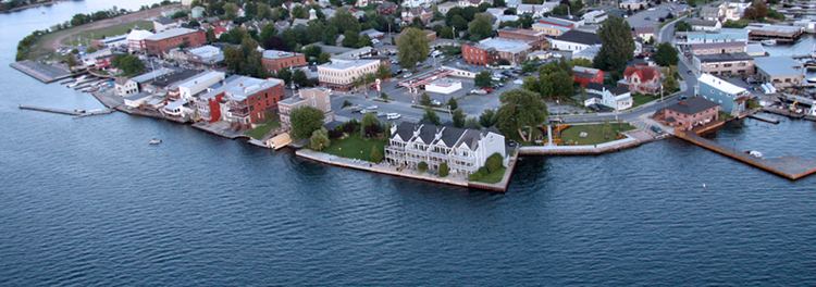
The Village of Clayton, nearby Cape Vincent, NY, and Alexandria Bay, NY are popular tourist destinations on the New York mainland side of the Thousand Islands region.
History
The area was first settled around 1801.
The town was formed from parts of the Town of Orleans and Lyme in 1833. The town was named after statesman John M. Clayton. The Village of Clayton became the main railroad terminus for the Thousand Islands resort region, during its heyday at the turn of the twentieth century. The Town of Clayton offered several hotels to visitors, some grand, now mostly vanished.
In 1872, the community of Clayton voted to set itself apart from the town by incorporating as a village.
Fairview Manor, Swarthout Site-A04507.000038, and Grindstone Island Upper Schoolhouse are listed on the National Register of Historic Places.
Geography
According to the United States Census Bureau, the town has a total area of 104.0 square miles (269.4 km²), of which, 82.6 square miles (213.8 km²) of it is land and 21.5 square miles (55.6 km²) of it (20.64%) is water.
The town is situated on the St. Lawrence River near Lake Ontario. Across the river lies Ontario, Canada.
The northern border of the town is the Canada–US border running through the Thousand Islands of the St. Lawrence River. The town includes one of the larger Thousand Islands, Grindstone Island, along with smaller islands, such as Bluff Island, Grenell Island, Maple Island, Picton Island, and Round Island.
A ferry once connected Clayton with Gananoque in Ontario, but was discontinued due to the construction of the Thousand Islands Bridge ten miles down-river. This bridge now carries Interstate 81 to Canada.
New York State Route 12E, which follows the south bank of the St. Lawrence River, intersects north-south New York State Route 12 at Clayton village. New York State Route 180 crosses the southeast corner of Clayton.
Demographics
As of the census of 2000, there were 4,817 people, 1,914 households, and 1,335 families residing in the town. The population density was 58.3 people per square mile (22.5/km²). There were 3,337 housing units at an average density of 40.4 per square mile (15.6/km²). The racial makeup of the town was 97.24% White, 0.93% Black or African American, 0.35% Native American, 0.23% Asian, 0.10% Pacific Islander, 0.48% from other races, and 0.66% from two or more races. Hispanic or Latino of any race were 1.58% of the population.
There were 1,914 households out of which 34.5% had children under the age of 18 living with them, 57.0% were married couples living together, 8.6% had a female householder with no husband present, and 30.2% were non-families. 25.1% of all households were made up of individuals and 13.0% had someone living alone who was 65 years of age or older. The average household size was 2.51 and the average family size was 3.00.
In the town, the population was spread out with 26.7% under the age of 18, 6.5% from 18 to 24, 29.0% from 25 to 44, 22.6% from 45 to 64, and 15.1% who were 65 years of age or older. The median age was 38 years. For every 100 females there are 94.1 males. For every 100 females age 18 and over, there are 91.7 males.
The median income for a household in the town was $35,805, and the median income for a family was $39,727. Males had a median income of $31,402 versus $21,091 for females. The per capita income for the town was $16,947. About 4.8% of families and 8.0% of the population were below the poverty line, including 11.0% of those under age 18 and 7.0% of those age 65 or over.