
Country United States GNIS feature ID 453206 Local time Monday 4:50 PM | FIPS code 18-13006 Elevation 222 m Population 2,817 (2010) | |
 | ||
Weather 13°C, Wind S at 29 km/h, 92% Humidity Area 52.08 km² (51.62 km² Land / 47 ha Water) | ||
Clay Township is one of fourteen townships in Cass County, Indiana, and one of the seventeen townships sharing the name in the state. As of the 2010 census, its population was 2,817.
Contents
- Map of Clay Township IN 46947 USA
- History
- Geography
- Cities and towns
- Unincorporated towns
- Adjacent townships
- Major highways
- Cemeteries
- References
Map of Clay Township, IN 46947, USA
History
Clay Township was organized in 1832. It was named for Henry Clay, three-term Speaker of the House of Representatives and Secretary of State.
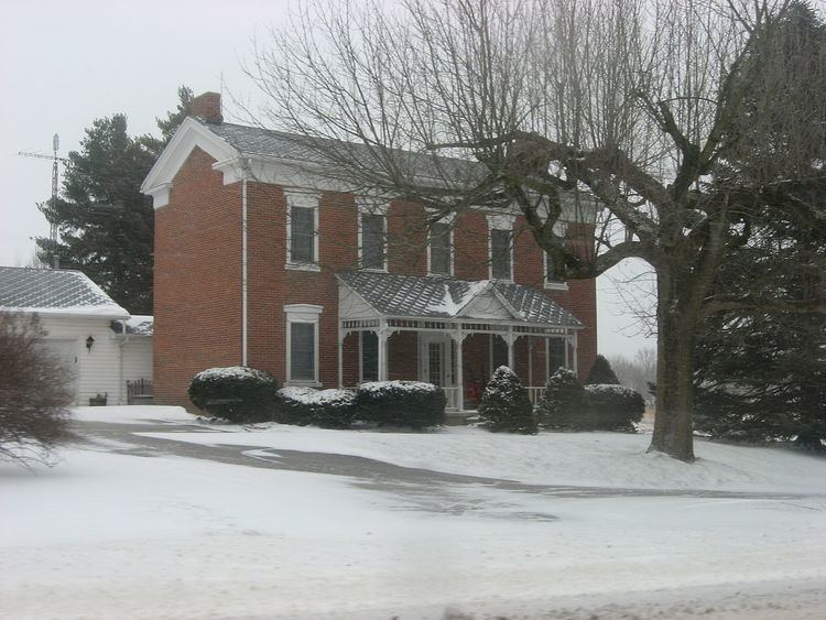
Thompson Barnett House was listed on the National Register of Historic Places in 1986.
Geography
According to the 2010 census, the township has a total area of 20.11 square miles (52.1 km2), of which 19.93 square miles (51.6 km2) (or 99.10%) is land and 0.18 square miles (0.47 km2) (or 0.90%) is water.
Cities and towns
Unincorporated towns
Adjacent townships
Major highways
Cemeteries
The township contains two cemeteries: Bethel and Wilson.
References
Clay Township, Cass County, Indiana Wikipedia(Text) CC BY-SA