
Length 50 km Country United States of America | ||
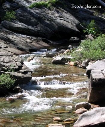 | ||
The Clavey River is a tributary of the Tuolumne River in the Sierra Nevada, located in the Stanislaus National Forest and Tuolumne County, California.
Contents
Map of Clavey River, California, USA
GeographyEdit
The river is about 31.4 miles (50.5 km) long.
Its headwaters are within the Emigrant Wilderness of the Stanislaus National Forest. Uniquely, it flows north-south, which is exceptional for a west-slope river in the Sierra Nevada. The river makes a sweeping right-hand turn at Jawbone Ridge prior to joining forces with the main stem of the Tuolumne River. The confluence is known as Clavey Falls.
The Tuolumne River is a tributary of the San Joaquin River.
FeaturesEdit
Clavey Falls provides a thrilling landmark to rafters and kayakers heading downstream. The river has notable swimming holes eroded into the granitic Sierra bedrock.
The Clavey is special because it has some of the highest biotic integrity of any river in California, remaining in relatively good flora/fauna/ecological condition. This river is unique because it still harbors a pre-glacial remnant population of coastal rainbow trout.
ConservationEdit
The Clavey River is one of the few undammed rivers in California, despite the many attempts to do so by the Turlock Irrigation District.
A multi-stakeholder group known as the Clavey River Ecosystem Project (CREP) is currently developing a baseline study and recommendations for the preservation of the Clavey.