
Named for William Clark Founded 15 December 1818 | Largest city Arkadelphia Population 22,743 (2013) | |
 | ||
Website www.clarkcountyarkansas.com Colleges and Universities Henderson State University, Ouachita Baptist University, Arkadelphia Beauty College Points of interest Arkadelphia Aquatic Park, Rowdy Adventures, DeSoto Bluff Trail, Clark County Historical, Feaster Park | ||
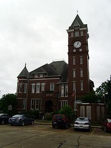
Clark County is a county located in the U.S. state of Arkansas. As of the 2010 census, the population was 22,995. The county seat is Arkadelphia. The Arkadelphia, AR Micropolitan Statistical Area includes all of Clark County.
Contents
- Map of Clark County AR USA
- History
- Geography
- Major highways
- Adjacent counties
- Demographics
- Cities
- Towns
- Unincorporated communities
- Townships
- Notable residents
- References
Map of Clark County, AR, USA
History
Clark County was Arkansas' third county, formed on December 15, 1818, alongside Hempstead and Pulaski counties. The county is named after William Clark who at the time was Governor of the Missouri Territory, which included present-day Arkansas. On November 1, 1833, Pike County was created, out of western Clark County and part of northern Hempstead County by the Arkansas territorial legislature and named after Zebulon Pike. Arkadelphia was named as the county seat in 1842.
Geography
According to the U.S. Census Bureau, the county has a total area of 883 square miles (2,290 km2), of which 866 square miles (2,240 km2) is land and 17 square miles (44 km2) (1.9%) is water.
Major highways
Adjacent counties
Demographics
As of the 2000 United States Census, there were 23,546 people, 8,912 households, and 5,819 families residing in the county. The population density was 27 people per square mile (10/km²). There were 10,166 housing units at an average density of 12 per square mile (5/km²). The racial makeup of the county was 74.28% White, 22.02% Black or African American, 0.46% Native American, 0.62% Asian, 0.04% Pacific Islander, 1.37% from other races, and 1.20% from two or more races. 2.40% of the population were Hispanic or Latino of any race.
There were 8,912 households out of which 29.80% had children under the age of 18 living with them, 49.80% were married couples living together, 12.20% had a female householder with no husband present, and 34.70% were non-families. 27.60% of all households were made up of individuals and 12.40% had someone living alone who was 65 years of age or older. The average household size was 2.38 and the average family size was 2.91.
In the county, the population was spread out with 21.70% under the age of 18, 20.00% from 18 to 24, 23.80% from 25 to 44, 19.90% from 45 to 64, and 14.60% who were 65 years of age or older. The median age was 32 years. For every 100 females there were 92.70 males. For every 100 females age 18 and over, there were 88.90 males.
The median income for a household in the county was $28,845, and the median income for a family was $37,092. Males had a median income of $28,692 versus $19,886 for females. The per capita income for the county was $14,533. About 13.50% of families and 19.10% of the population were below the poverty line, including 20.90% of those under age 18 and 18.40% of those age 65 or over.
Cities
Towns
Unincorporated communities
Townships
Note: Unlike most Arkansas counties, Clark County only has one single township. That township encompasses the entire county.
Townships in Arkansas are the divisions of a county. Each township includes unincorporated areas; some may have incorporated cities or towns within part of their boundaries. Arkansas townships have limited purposes in modern times. However, the United States Census does list Arkansas population based on townships (sometimes referred to as "county subdivisions" or "minor civil divisions"). Townships are also of value for historical purposes in terms of genealogical research. Each town or city is within one or more townships in an Arkansas county based on census maps and publications. The townships of Clark County are listed below; listed in parentheses are the cities, towns, and/or census-designated places that are fully or partially inside the township.