
Time zone CET (UTC+1) Local time Tuesday 9:09 PM | Region Normandy Canton Clères (chef-lieu) Area 11.36 km² Population 1,266 (1999) | |
 | ||
Weather 6°C, Wind S at 6 km/h, 70% Humidity | ||
Clères is a commune in the Seine-Maritime department in the Haute-Normandie region in north-western France.
Contents
- Map of 76690 ClC3A8res France
- Geography
- Places of interest
- People with links to the commune
- Twin towns
- References
Map of 76690 Cl%C3%A8res, France
Geography
A farming and forestry market town situated by the banks of the Clérette river, in the Pays de Caux, some 17 miles (27 km) northeast of Rouen, at the junction of the D 2, D 6, D 53 and the D 100 roads. SNCF has a TER railway station in the town.
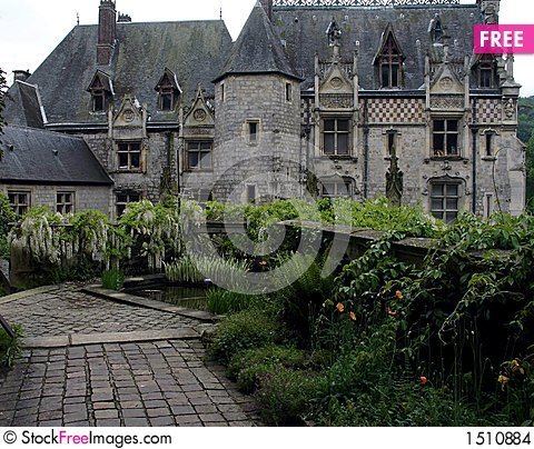
Places of interest
People with links to the commune
Twin towns
References
Clères Wikipedia(Text) CC BY-SA