
Population 906 Civil parish Leigh CP Country England Shire county Staffordshire Dialling code 01889 | OS grid reference SK020350 Region West Midlands Sovereign state United Kingdom District East Staffordshire UK parliament constituency Burton | |
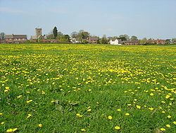 | ||
Church Leigh is a village and largest settlement in the civil parish of Leigh in the English county of Staffordshire, England. The village is 6.2 miles (10.0 km) WNW of the town of Uttoxeter, 14.3 miles (23.0 km) north east of Stafford and 148 miles (238 km) north west of London.
Contents
- Map of Church Leigh Stoke on Trent UK
- Transport
- History
- Localities
- Withington
- Upper Leigh
- Lower Leigh
- Morrilow Heath
- Middleton Green
- Dods Leigh
- Godstone
- Field
- References
Map of Church Leigh, Stoke-on-Trent, UK
Transport
The village lies 0.8 miles south of the A50 that runs from Warrington to Leicester and is dualled on this section (between Stoke-on-Trent and the M1 motorway).
The nearest railway station is at Uttoxeter for the Crewe to Derby line on the national network.
The nearest airport is East Midlands Airport between Derby, Loughborough and Nottingham.
History
Church Leigh has an entry in the Domesday Book of 1085. In the great book Church Leigh is recorded by the name Lege
Localities
The civil parish of Leigh is centred on the clustered village of Church Leigh but has six satellite hamlets. Separating the last four from the first is a field buffer including the River Blithe which flows south, via the Blithfield Reservoir lake 5 miles (8.0 km) south to feed the River Trent at Alrewas, Staffordshire.
Withington
Withington is a linear settlement on five lanes that is separated to the west from Church Leigh by fields covering 300m; its oldest farmhouse is a listed building.
Upper Leigh
Upper Leigh is a linear settlement on five or six lanes that is separated to the south-east from Lower Leigh by fields covering 100m; it has three listed buildings: Moor Farm, Moor House Farm and Manor Farm.
Lower Leigh
Lower Leigh is on a winding lane, separated from the village Primary School and recreation ground by less than 100 metres, to its north-west. The middle of the parish's three bridges along the lanes over the River Blithe is close to the centre of Lower Leigh. Next to this bridge is the aptly-named Brook Farmhouse.
Morrilow Heath
This is the largest hamlet in area and population, and the most remote. To the south-west, it is on high ground and has a salient boundary as far as the source of the Sprink Brook.
Middleton Green
Middleton Green is small in population and less than 200m north-east of Morrilow Heath and is 1 mile (1.6 km) south-west of Lower Leigh. Birchwood Park, an isolated farm, towards the Sprink Brook was historically a manor of sorts and is an architectural listed building, like the others in the parish which are non-ecclesiastical, at Grade II only. Big Wood, rises to the southern border here with extensive views over the rest of the village
Dods Leigh
This traditionally agricultural cluster of buildings includes a chapel, and is 0.5 miles (0.80 km) south of Lower Leigh.
Godstone
Just 300m south of Dods Leigh, a traditional manor forms a linear settlement, the traces of which can be made out from the properties, The Orchard, Godstone House and Godstone Cottage, as well as Old Woodcutter, the main four buildings.
Field
Six farms make up a cluster which forms Field; the Sprink Brook discharges to the River Blythe at a point in the south of the hamlet.