
Population 344 (2011 census) Postcode(s) 3775 Area 4.4 km² Local time Tuesday 12:14 AM | Established 1884 Elevation 152 m Postal code 3775 | |
 | ||
Weather 17°C, Wind SE at 16 km/h, 72% Humidity | ||
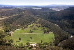
Christmas Hills is a town in Victoria, Australia, 35 km north-east of Melbourne's Central Business District in the local government area of the Shire of Nillumbik. At the 2011 Census, Christmas Hills had a population of 344.
Contents
- Map of Christmas Hills VIC 3775 Australia
- History
- Present Day
- Christmas Hills township
- Rob Roy
- One Tree Hill
- Sugarloaf Reservoir
- Transport
- References
Map of Christmas Hills VIC 3775, Australia
Christmas Hills is located between Kangaroo Ground and Yarra Glen, along Eltham-Yarra Glen Road (State Route C726), north of the Yarra River, in the Dandenong Ranges. In 1904, the Australian Handbook described Christmas Hills as "an excellent health resort".
The locality is very hilly, with One Tree Hill in the northwest rising to 372 m above sea level, and is home to several reserves, including One Tree Hill Reserve and Sugarloaf Reservoir Park, opened in 1980 and managed by Melbourne Water.
History
Christmas Hills owes its name to an emancipated convict and shepherd, David Christmas, who became lost on a 640-acre (2.6 km2) grazing lease in the area in 1842, and was found after days of wandering at a rise which was subsequently named after him. The area was considered to have poor quality soil, although nearby settlers earned an income from chopping firewood in the sclerophyll forests.
Gold was discovered at One Tree Hill in 1859, fuelling a brief goldrush. Quartz reef operations ended in 1864, and alluvial mining continued until 1908.
The area grew considerably in the 1870s; at one point the town had two hotels, two schools, a post office and a Mechanics' Institute.
The Post Office opened on 10 December 1874 as Christmas Hill, was renamed in 1913, and closed in 1974.
In 1884, a primary school was built, and by 1912, when the railway from Heidelberg to Hurstbridge was built, the area had a population of 146 and had become a tourist destination, popular with Melburnians seeking "clean air and an invigorating climate".
In 1893, 1939, 1962 and 2009, the area suffered from destructive bushfires.
Present Day
Christmas Hills today is a large area encompassing several districts.
Christmas Hills township
The Christmas Hills township consists of a cluster of homes, a public hall, a tennis court, a memorial park with a World War I monument and a fire brigade shed, erected after the 1939 bushfires. About 1 km to the west is Christmas Hills Primary School, first established in 1884, with an enrolment of 22 students in 2006.
Rob Roy
Rob Roy (37°38′56″S 145°17′10″E) in the western part is used for a range of hill racing events by the MG Car Club of Victoria. It was first established in 1937 by motoring enthusiasts and the Light Car Club for hill-racing motorbikes and cars and was utilised as a venue well into the postwar years. It was burnt out in 1962, but the track was later bitumenised.
One Tree Hill
One Tree Hill (37°37′59″S 145°18′36″E), (not to be confused with the TV show) a former mining area in northwestern Christmas Hills, is now a 143 hectare reserve managed by Parks Victoria. Its main features are Happy Valley Creek, which runs through the reserve, and the 372 m One Tree Hill in the northeast. According to the Land Conservation Council of Victoria, it has been assessed as "being of State botanical significance for its ecological integrity and viability, rarity and representation of community types", and is home to 22 species assessed as regionally threatened, rare or restricted in the greater Melbourne area, including roosting colonies of large bent-wing bat and eastern horseshoe bat, and the powerful owl, brush-tailed phascogale and barking owl. The LCC reports that 79 bird, 24 mammal, 7 reptile and 7 frog species have been recorded in the reserve.
Sugarloaf Reservoir
Sugarloaf Reservoir (37°40′30″S 145°17′33″E) is a 440-hectare reservoir which has a total water capacity of 96,000 megalitres, and was developed in the late 1970s and completed in 1981. It is managed by Melbourne Water and supplies scheme water to Melbourne's northern, western and inner suburbs. Sugarloaf is fed by the Maroondah Aqueduct and the Yarra River, and before entering the domestic water supply, water is treated at the Winneke Water Treatment Plant on the south bank of the reservoir to World Health Organisation guidelines. The main dam is 89 m high and 1,050 m long.
Around the reservoir is the Sugarloaf Reservoir Park, which opened in 1982 and is managed by Parks Victoria. The park's entrance, open during most daylight hours, is 1.2 km off Eltham-Yarra Glen Road. Barbecue and picnic facilities are available at Saddle Dam, south-east of the dam wall, and Ridge Park to the North. Several walking trails can be used with permission of Parks Victoria. Watercraft are only permitted to launch from the Sugarloaf Sailing Club on the north bank, and sail boards, keel boats and/or craft with cabins, cooking or toilet facilities are not permitted on the Reservoir. The area is home to eastern grey kangaroos, echidnas, wedge-tailed eagles, crimson rosellas and other wildlife including a population of deer. Vegetation ranges from grassland, having been cleared for agriculture in the decades prior to the reservoir's construction, to dry forest.
Transport
The nearest public transport is by bus to Yarra Glen 9 km downhill to the east. However, driving is a much more viable option, considering the time and distance taken to use public transport, and spread of the towns.