
Population 80,870 (Dec 2008) | Area 67.2 km² Local time Monday 4:36 AM | |
 | ||
Weather 6°C, Wind S at 11 km/h, 87% Humidity Points of interest Rhine, Naherholungsgebiet Fühlinger See, Sundown Beach, Worringer Bruch | ||
Chorweiler (German: Köln-Chorweiler, [kɔʁvaɪlɐ]) is the Sixth city district (Stadtbezirk) of Cologne, Germany. Large portion of the district of Chorweiler were incorporated into the city of Cologne in 1922, the quarter of Chorweiler was created in the 1970s. The district has the lowest population density in Cologne and many areas are very rural.
Contents
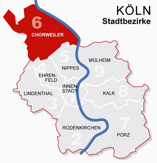
Map of Chorweiler, Cologne, Germany
The District of Chorweiler borders with the Cologne boroughs of Nippes and Ehrenfeld to the South, Rhein-Erft-Kreis to the West, Rhein-Kreis Neuss to the North, and the Rhine to the East. On the other riverbank lies the city of Leverkusen.
Subdivisions
Chorweiler consists of twelve Stadtteile (city parts):
Transportation
Chorweiler is served by numerous railway stations and highway. Train station include Köln-Chorweiler, Köln-Chorweiler Nord, Köln-Volkhovener Weg and Köln-Worringen, as well as numerous light rail stations of Cologne Stadtbahn line 12 and 15. The Bundesautobahn 57 connects Chorweiler with the Cologne Beltway.