
First ascent 3 August 1932 | Elevation 6,354 m Prominence 919 m | |
 | ||
Similar Huascarán, Nevado Pisco, Alpamayo, Tocllaraju, Huandoy | ||
Nevado chopicalqui
Chopicalqui or Chopicallqui (possibly from Ancash Quechua kallki ravine) is a mountain in the Cordillera Blanca area in the Andes of Peru. With a summit elevation of 6,354 metres (20,846 ft) above sea level it is one of the highest peaks of the Cordillera Blanca. It lies in Yungay Province, Ancash, between the mountains Huascarán and Contrahierbas.
Contents
- Nevado chopicalqui
- Map of Chopicalqui Peru
- Peru expedition nevado chopicalqui 6354 m 11 07 2016 dav deutscher alpenverein sektion ulm
- ClimbingEdit
- References
Map of Chopicalqui, Peru
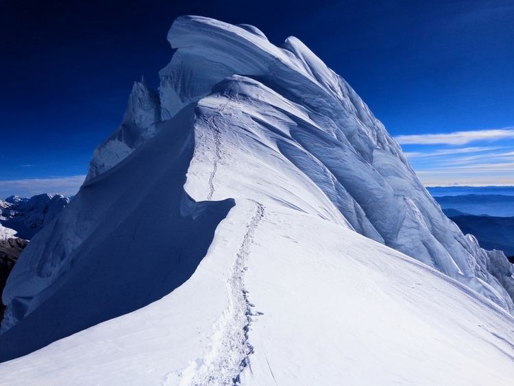
Peru expedition nevado chopicalqui 6354 m 11 07 2016 dav deutscher alpenverein sektion ulm
ClimbingEdit
The standard climbing route is the Southwest Ridge, a moderate snow climb that is popular with climbers and can be crowded at times. It possesses a difficulty rating of PD+/AD- on the French System for grading alpine routes but deep snow on the summit slopes causes most failures for parties attempting the ridge.
Other established climbing routes include the following:
- Southeast Ridge (alpine grade TD-).
- East Face Direct (alpine grade TD).
References
Chopicalqui Wikipedia(Text) CC BY-SA