
Founded January 2, 1857 Time zone PET (UTC-5) Elevation 2,473 m | Region Arequipa Capital Choco UBIGEO 040406 Area 904.3 km² | |
 | ||
Choco District is one of fourteen districts of the province Castilla in Peru.
Contents
Map of Choco, Peru
Geography
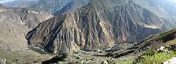
The Chila mountain range traverses the district. One of the highest mountains of the district is Chila at 5,654 m (18,550 ft) above sea level. Other mountains are listed below:
Ethnic groups
The people in the district are mainly indigenous citizens of Quechua descent. Quechua is the language which the majority of the population (67.11%) learnt to speak in childhood, 32.23% of the residents started speaking using the Spanish language (2007 Peru Census).
References
Choco District Wikipedia(Text) CC BY-SA